Pittsburgh Weather: Sunday Snow Showers
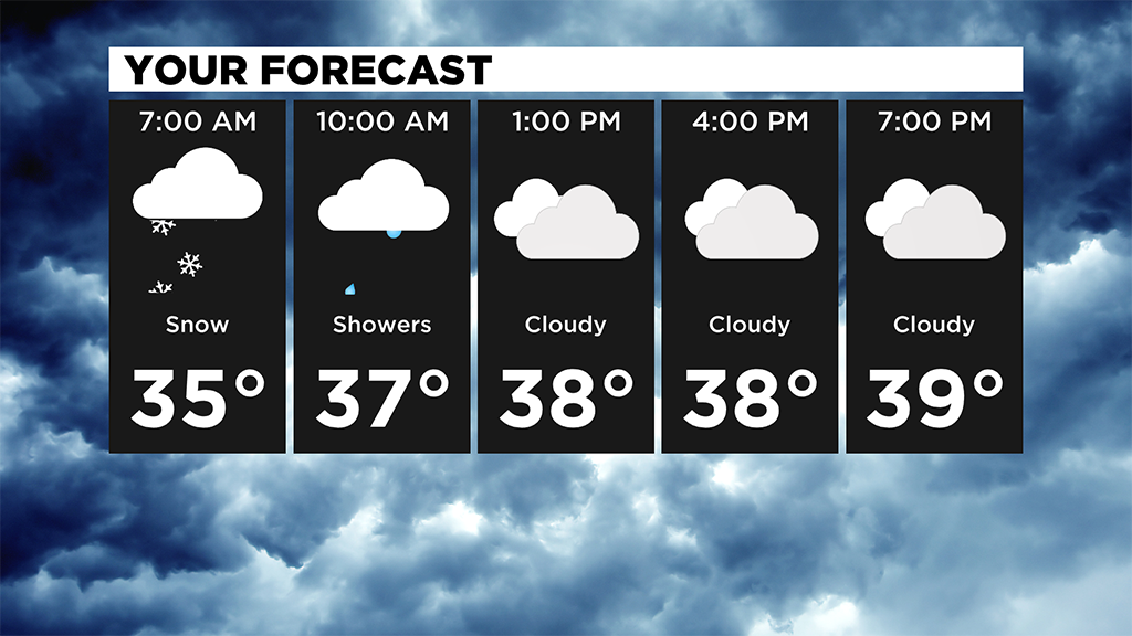
PITTSBURGH (KDKA) -- Snow showers started last night and will last through the morning.
Some areas are seeing a mix and we should dry out by later this afternoon.
Less than an inch expected for many and high temperatures today will be near 40 degrees.
The precipitation wraps up by late afternoon and through the evening.
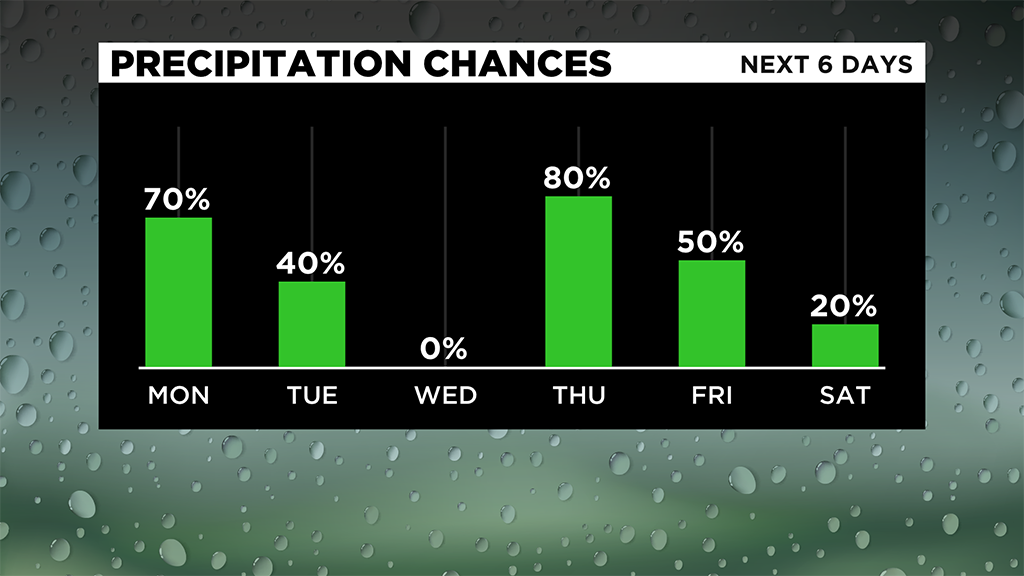
Monday is the first day of Winter (Winter Solstice) at 5:02 a.m. and there's a chance for a few rain and snow showers in the evening that look to linger into Tuesday as snow showers.
The ridges and north of I-80 could pick up an inch or so.
Pittsburgh is looking at little to no accumulation.
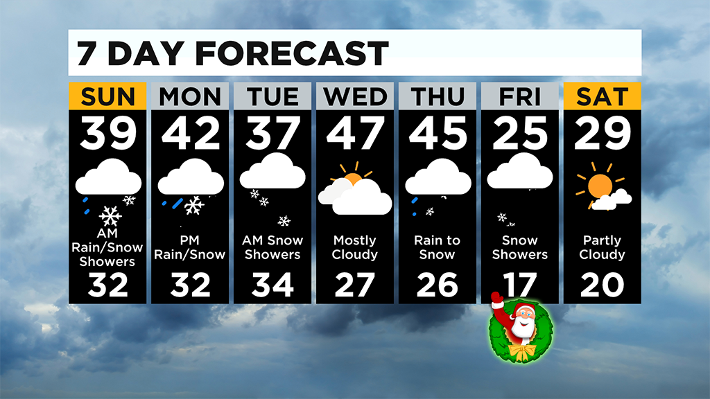
Wednesday, we see temperatures in the upper 40's and even a peak or two of sunshine, but don't let that fool you.
We are looking at the coldest temperatures of the season to arrive by Christmas!
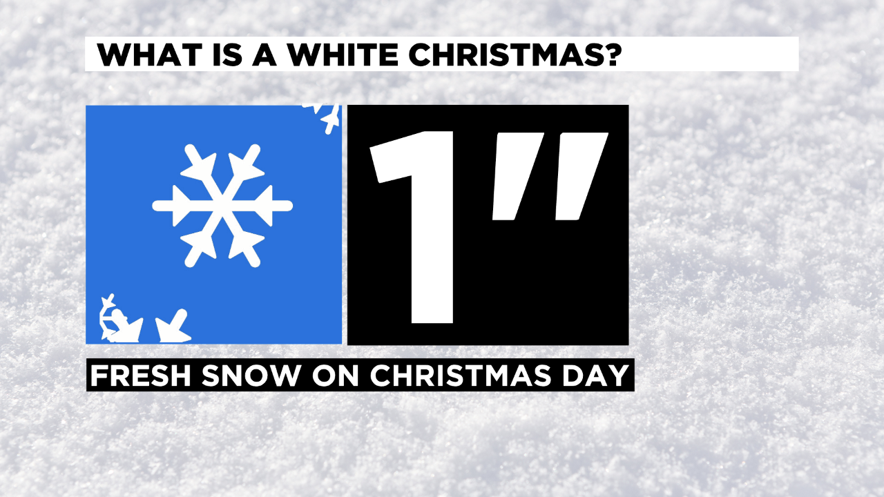
A white Christmas isn't out of the question just yet either.
We are still seeing a chance for a mix on Christmas Eve with highs near 40 degrees then scattered snow showers on Christmas morning with highs only in the low to mid 20's and lows dropping to the teens!
Remember: You need 1" of fresh snow on the ground on Christmas morning to officially call it a "White Christmas".
WEATHER LINKS:
Current Conditions | School Delays & Closings | Local Radar | Weather App | Photos
Stay up to date with the KDKA app, which you can download here.