Pittsburgh Weather: Sunday Showers, Storm Chances
PITTSBURGH (KDKA) -- A warm front lifting through Southwestern Pennsylvania has brought big changes to our weather pattern since yesterday's sunshine.
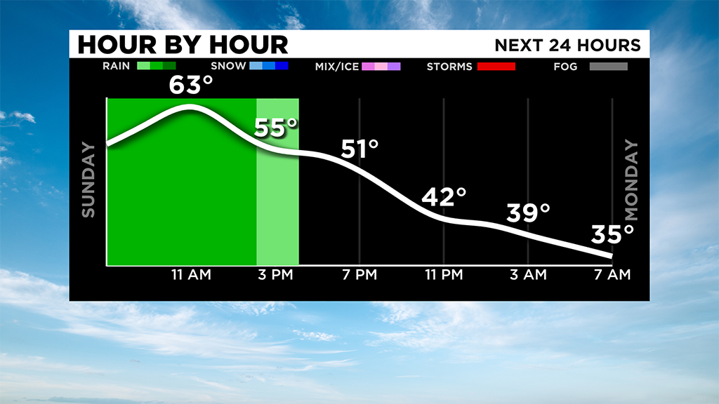
Rain will linger most of the day today with temperatures reaching the lower to mid-60's by lunchtime.
A cold front swings through the area this afternoon bringing gusty winds, with a few isolated thunderstorms and a big drop in temperatures tonight.
Lows will dip into the lower to mid-30's by Monday morning and the last few showers tonight could change to snow showers along the I-80 corridor and in the Laurel Highlands.
The highest elevations could wind up with a dusting of snow by Monday morning!
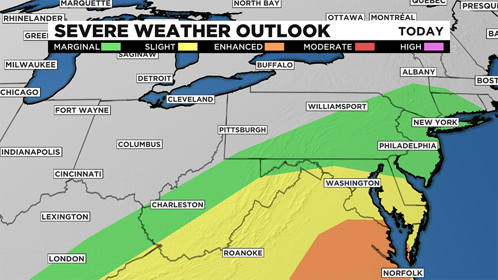
The best chance for any strong thunderstorms this afternoon will be south and east of Pittsburgh with a severe weather threat staying farther to the south of our area.
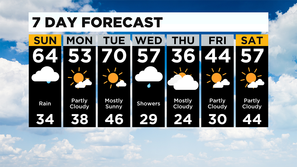
Temperatures are on a rollercoaster this week bouncing back to 70 by Wednesday, plunging to the 30's Thursday then climbing back to near 60 for Easter!
WEATHER LINKS:
Current Conditions | School Delays & Closings | Local Radar | Weather App | Photos
Stay up to date with the KDKA app, which you can download here.