Pittsburgh Weather: Complex Winter System Forces First Alert Days On Friday, Saturday
By: Mary Ours and Ray Petlin/KDKA-TV
PITTSBURGH (KDKA) - A very complicated system will be moving into the region Thursday evening bringing a bag of mixed precipitation.
ALERT: Hazardous weather arrives right around the evening commute with snow north of I-80. Freezing rain is expected along the ridges and north of Pittsburgh, and heavy rain is expected south of Interstate 70. A Winter Weather Advisory starts for counties north of Pittsburgh at 6 p.m. and an Ice Storm Warning begins at 5 p.m. for the ridges and Laurels.
AWARE: Flood advisory for the Ohio River at the Point (Downtown Pittsburgh) goes until Monday morning. The river is expected to crest at 20.5' on Saturday morning. Part of the Mon Wharf will be topped along with parts of the North Shore River Walk.
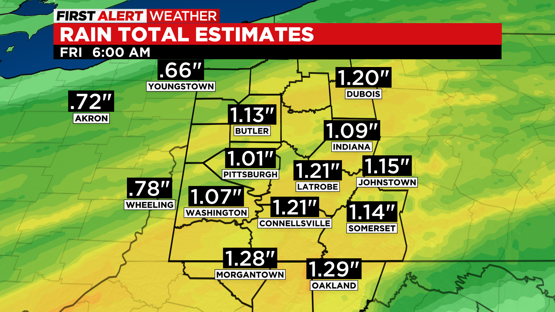
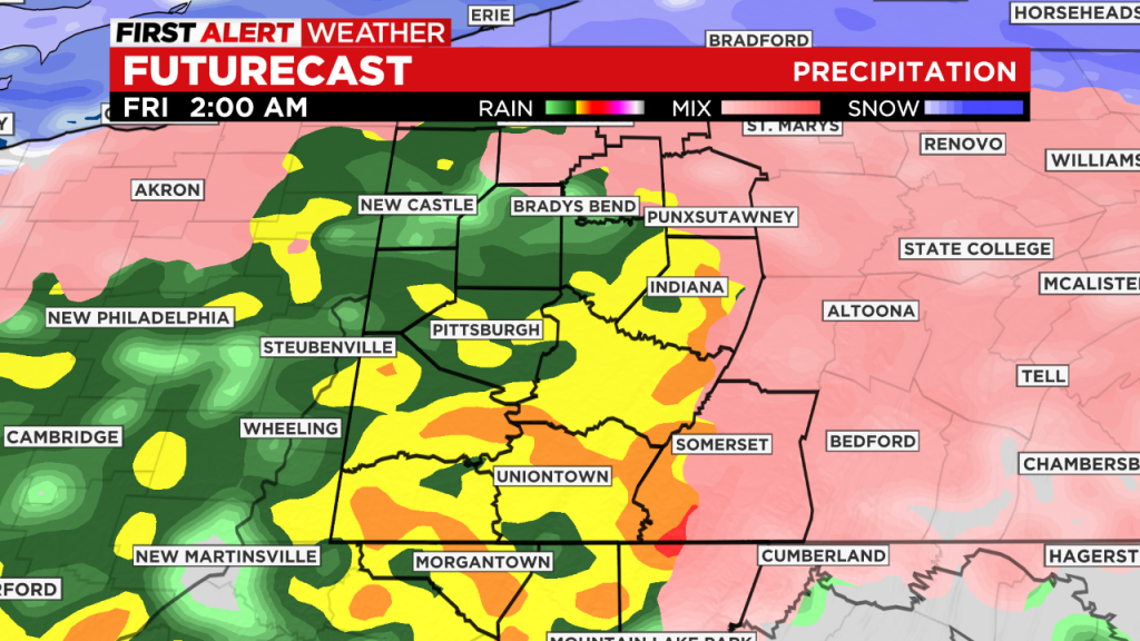
All seems to remain on track with the winter storm system passing through our region. While this is a winter storm, snow is not a big part of this one for us. Heavy rain will fall from Pittsburgh southward.
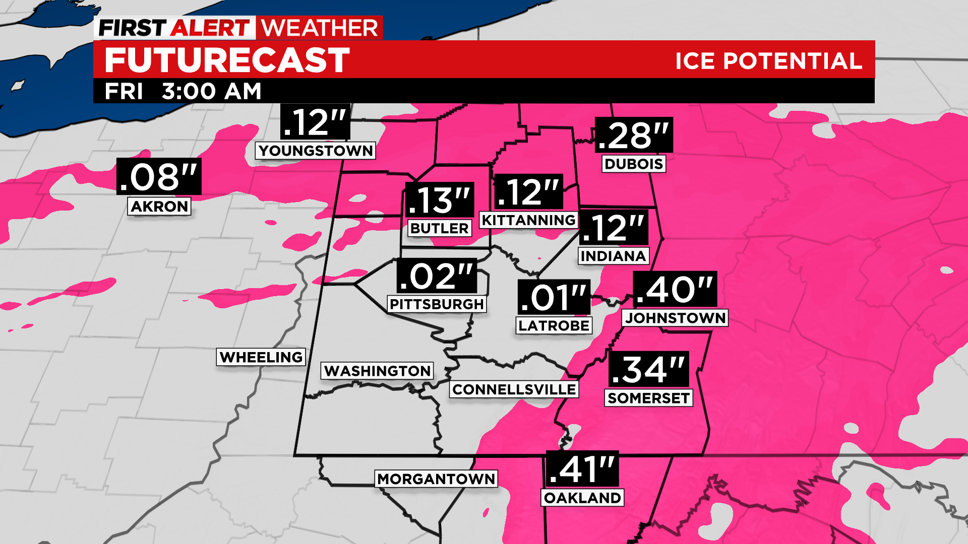
North of the city, a wintry mix will last for several hours before changing to rain. The ridges stand to have the most major impacts with significant freezing rain. Remember, freezing rain is the icy glaze, so this could lead to power outages and treacherous travel conditions overnight.
North of Pittsburgh, where we have the winter weather advisory, slick travel is possible in spots, but rain will eventually spread northward toward I-80.
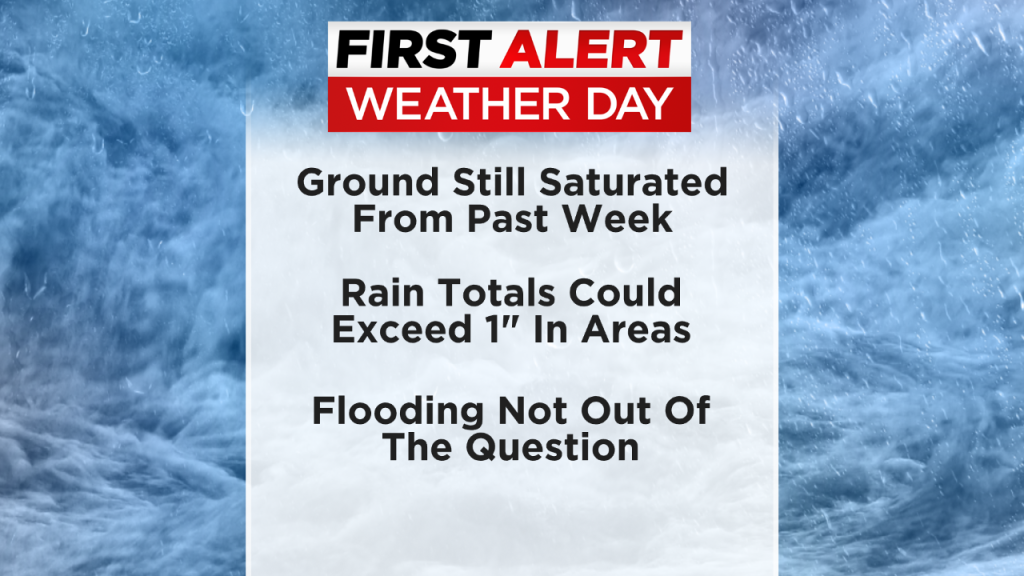
In and south of Pittsburgh, heavy rain is likely. Some spots could pick up more than an inch of rainfall. The ground is still saturated from a couple of rounds of heavy rain in the last week, so flooding will become possible, especially in flood-prone, low lying and poor drainage areas.
Friday morning's commute will bring some light snow showers, but there will hardly be any accumulation. Watch for slick spots with ponding on the roadways and even flooding in low-lying areas. It'll only be in the mid 20s for daytime temperatures Friday, so a refreeze is also possible.
The weekend will be quiet, with cold mornings and mostly sunny skies during the afternoon with highs in the mid 30s Saturday and near 40 Sunday.
WEATHER LINKS
Current Conditions | School Delays & Closings | Local Radar | Weather App | Photos
Stay up to date with the KDKA app, which you can download here.