Pittsburgh Weather: Single-Digit Low Temperatures Hang Around Next 2 Nights
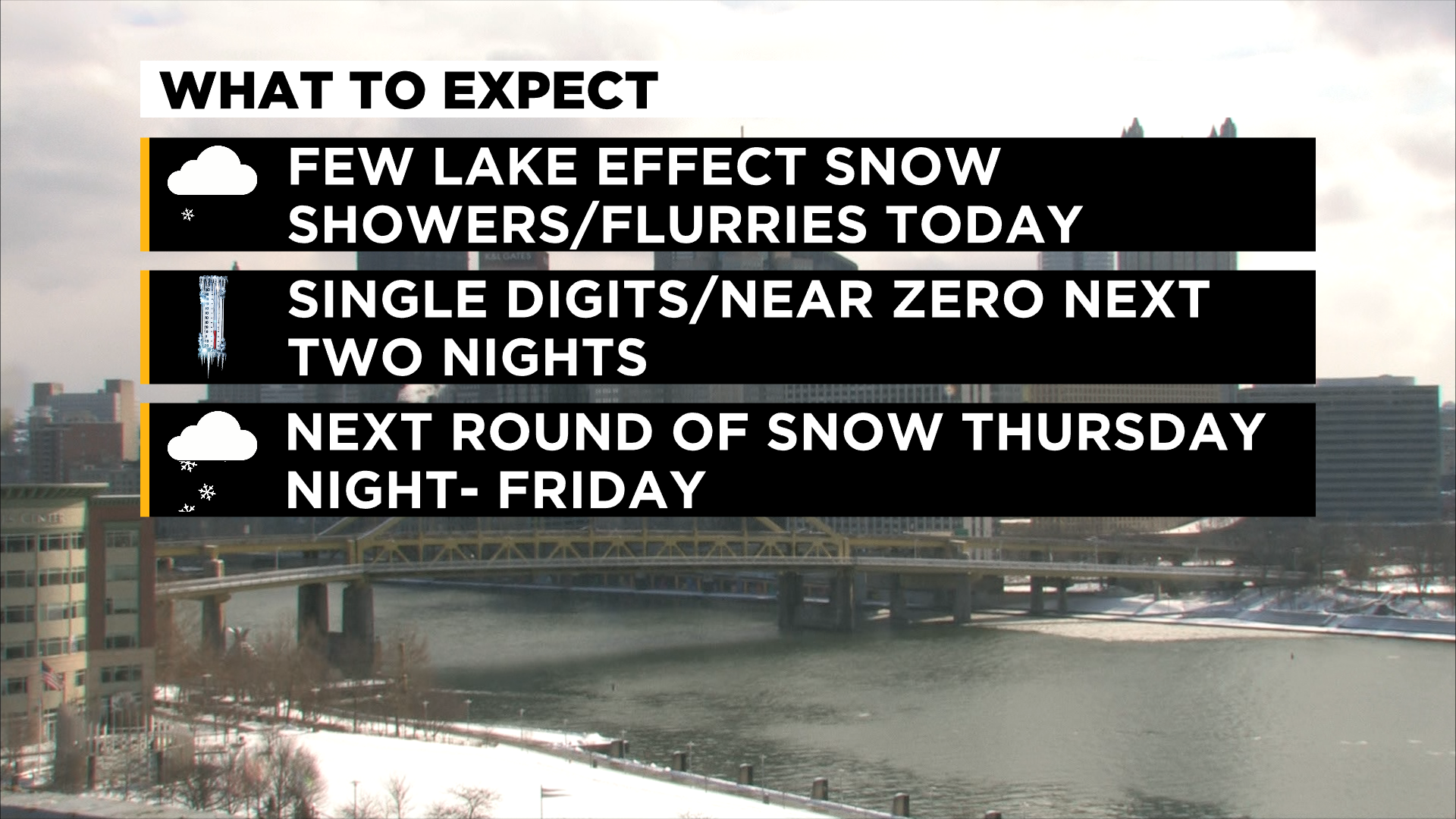
PITTSBURGH (KDKA) -- Lake effect snow showers are winding their way through the region with occasional flurries or a brief snow shower, alternating in spots with clouds and even some peeks of sunshine Tuesday afternoon.
WEATHER LINKS
Current Conditions | School Delays & Closings | Local Radar | Weather App | Photos
Most of the snow showers will linger in the Laurel Highlands through mid-afternoon before clouds break a bit Tuesday night.
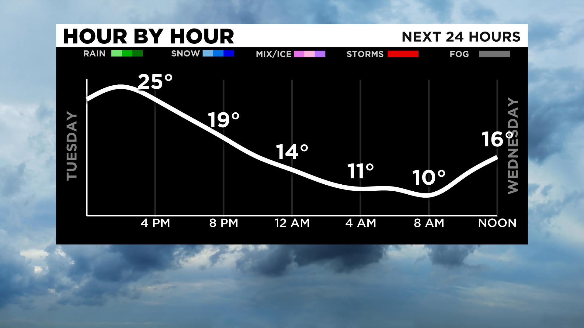
Cold air is expected to filter in behind the system and temperatures will drop through the evening and down into the single digits Tuesday night.
We'll only recover back into the upper teens and close to 20 in spots Wednesday before skies clear, allowing even colder readings near zero degrees for many spots Thursday morning.
Wind chills will be very cold the next two days in the single digits and below zero for a period of time.
Cold air will stick around through the weekend with another round of snow showers Thursday night into Friday, bringing us a chance for an additional inch or so of accumulation.