Pittsburgh Weather: Chance Of Rain On The Radar After Week-Long Dry Stretch
PITTSBURGH (KDKA) - For the first time in nearly a week, there's some incoming rain on the radar.
A few showers finally appeared on the radar this morning, but they were fleeting.
Pittsburgh woke up to temperatures in the mid to high 50s and mid 60s, a little warmer than average for this time of September.
KDKA Meteorologist Kristin Emery says we could see a few more spotty, isolated showers pop up later this afternoon as the day warms up and there's a bit more moisture in the air.
WEATHER LINKS:
Current Conditions | School Delays & Closings | Local Radar | Weather App | Photos
This chance for isolated, spotty showers is the first in almost after a week after Pittsburgh had a rare week of beautiful weather.
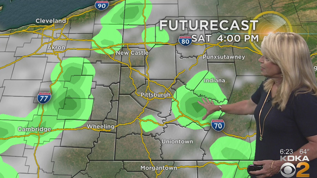
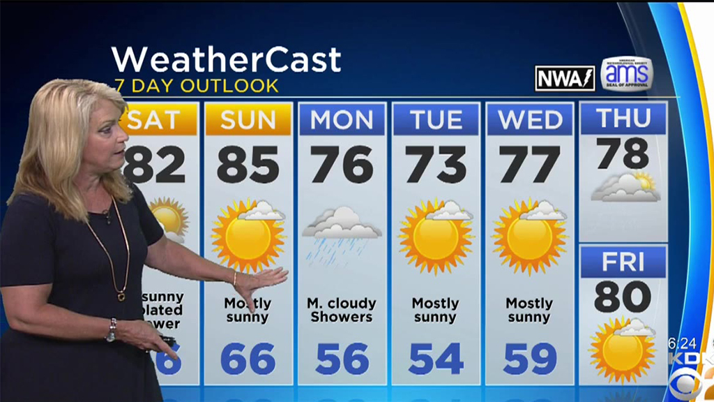
The best chance for rain will be between 4 p.m. and 8 p.m. Saturday night.
Otherwise, look for a partly sunny Saturday with temperatures still running about 10 degrees warmer than normal.
Highs will reach the lower 80s today and the mid-80s Sunday before a cold front arrives Monday (along with fall!).
Kristin Emery says we'll see a few showers and some cooler weather that will bring our highs down into the 70s starting Tuesday.
Stay up to date with the KDKA app, which you can download here.