Pittsburgh Weather: The Bitter Blast Is Here, How Long Will It Last?
PITTSBURGH (KDKA) - The chill has settled in.
It's going to stick around today and into tomorrow morning. Now we do have some good news this morning as clouds coming in off of Lake Erie has helped to keep temperatures up slightly above what we were expecting.
WEATHER LINKS:
Current Conditions | School Delays & Closings | Local Radar | Weather App | Photos
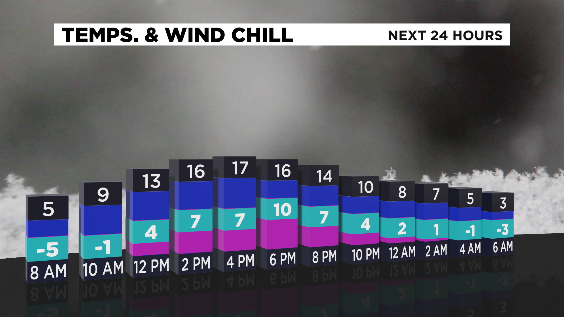
By 6:00 a.m., temperatures in Pittsburgh will have bottomed out around 10 degrees.
We still have nearly two hours to go before sunrise as I am writing this, so temperatures could easily still dive well into single digits.
Wind chills have been around zero all morning long though.
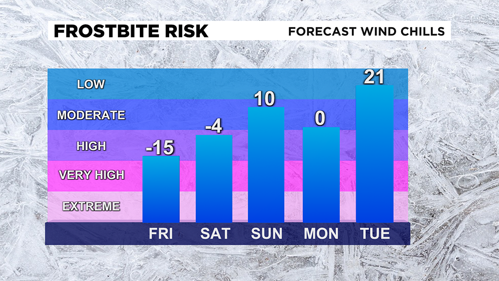
The frigid weather will stick around through Saturday morning, where air temperatures will be colder than this morning's temperatures. Winds will be lighter and you should expect wind chills to be near or slightly warmer than this morning's wind chills.
Highs on Saturday will go up to the upper 20s. Clouds will also roll in for the afternoon with winds out of the west southwest for the afternoon.
Snow chances return on Sunday afternoon and into the evening.
At this point, it looks like most places should expect less than an inch of snow overall.
Sunday highs should be near 30 degrees with the morning low coming in at 18. Winds will pick up behind the snow Sunday evening, leaving wind chills near 0 once again.
There is also a chance for snow on Tuesday with around an inch of snow expected.
Stay up to date with the KDKA app, which you can download here.