Philadelphia Weather: Tornado Watch Issued For Parts Of Pennsylvania, Delaware And New Jersey As Gusty Thunderstorms Head Towards Region
PHILADELPHIA (CBS) -- Get ready for some gusty thunderstorms to impact the afternoon drive on Friday followed by record-breaking heat to start the weekend. The Philadelphia area begins to warm up today as a warm front lifts north across the region.
The National Weather Service has issued a tornado watch for parts of Delaware, New Jersey, and Pennsylvania until 7 p.m. Friday.
A tornado watch has been issued for parts of Delaware, Maryland, New Jersey, Pennsylvania, Virginia and West Virginia until 7 PM EDT pic.twitter.com/WbvQHydxRh
— NWS Mount Holly (@NWS_MountHolly) May 20, 2022
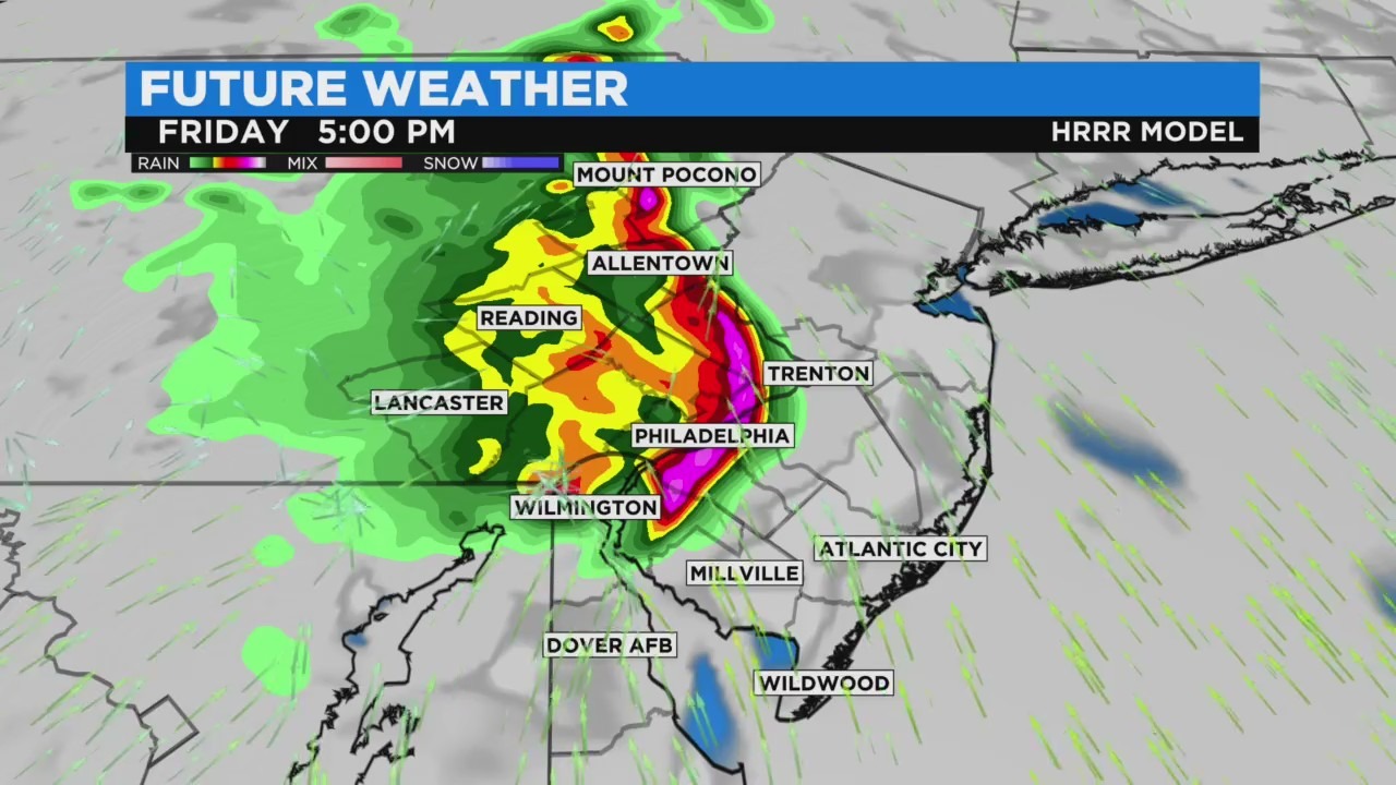
However, a cluster of gusty thunderstorms known as a Mesoscale Convective Vortex, or MCV, will race across the region late Friday afternoon with the threat for severe storms in spots.
The threat will mainly be from the city on north and west, with the timing likely between 3 and 6 p.m. The biggest threat with the complex of storms will be damaging straight-line wind gusts, and the area is under a marginal (1 out of 5) risk of severe weather.
After the storms clear, we'll be talking about dangerous heat.
A Heat Advisory will be in effect from 11 a.m. to 10 p.m. Saturday as heat index values around 100 degrees.
Our high will reach 97, breaking the record of 95 set in 1934.
Sunday will be another scorcher with a high of around 93 before a cold front brings scattered storms by evening.