Philadelphia Weather: Parts Of Region Could See Potentially Severe Thunderstorms Tuesday
PHILADELPHIA (CBS) -- The muggy heat is returning to the Philadelphia region on Tuesday, leading to a potential severe weather threat this afternoon. A cold front is approaching the area from the west, running into that building humidity.
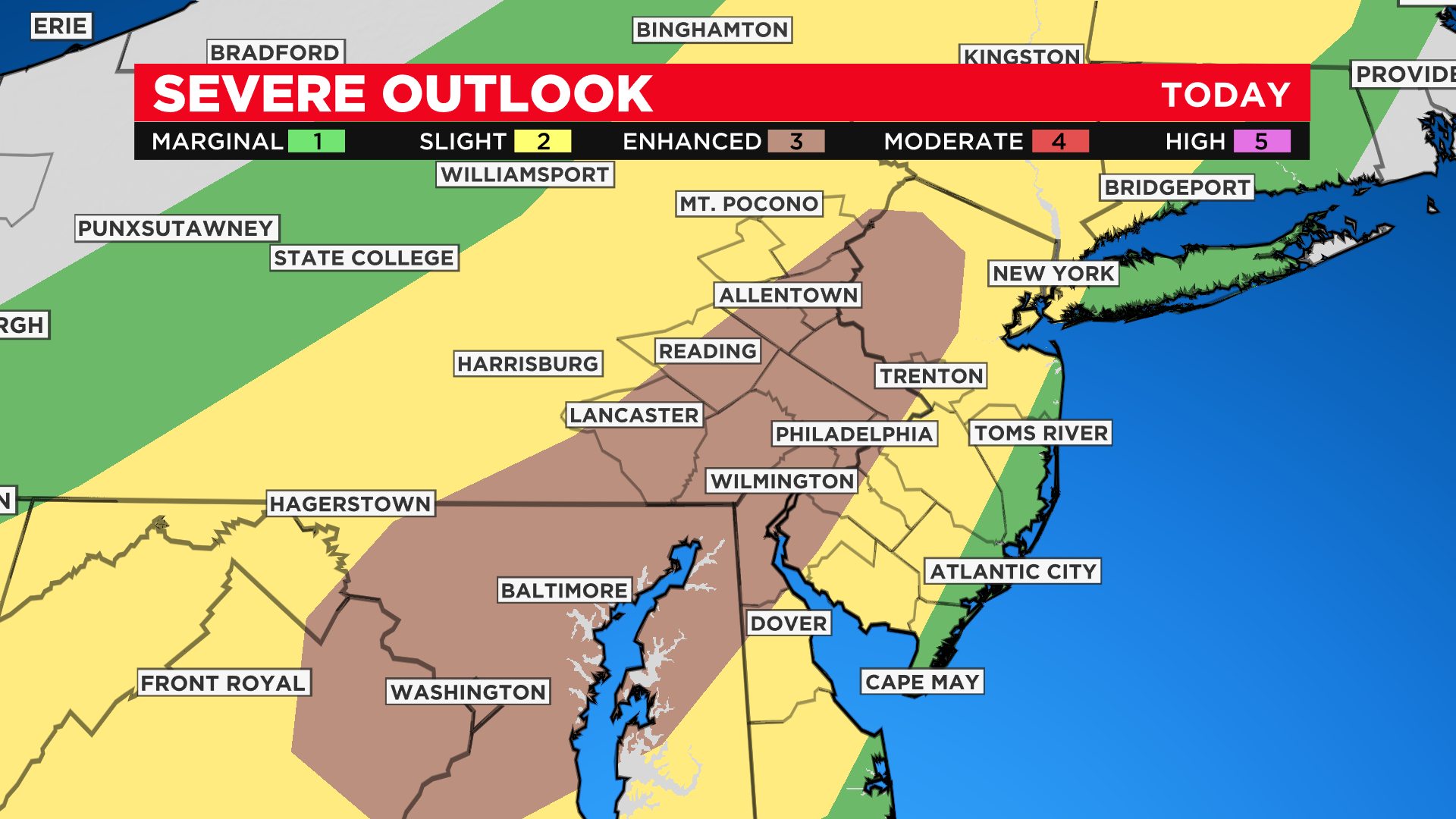
The Storm Prediction Center has elevated much of our area to an Enhanced Risk for severe storms this afternoon. Our main threats are the same: damaging winds and downpours. Isolated hail and a brief tornado can't be ruled out, but I don't expect everyone to get hit @CBSPhilly pic.twitter.com/tWdXO0wjpo
— Andrew Baglini (@AndrewBaglini4) July 12, 2022
Thunderstorms are expected to develop along that front in Central Pennsylvania early Tuesday afternoon before moving into the Philly area.
They will first impact areas north and west of Philadelphia, near Lancaster and Reading closer to 2 p.m.
Scattered thunderstorms pop up in Pennsylvania this afternoon. Not everyone gets hit, but storms can produce damaging winds and downpours. Shore points looking good, just breezy @CBSPhilly pic.twitter.com/U5MLJVBtAY
— Andrew Baglini (@AndrewBaglini4) July 12, 2022
As the storms continue to move east, they are expected to become scattered, meaning not every part of the region will see them, but the areas that do could get hit hard.
Most of the Philadelphia area is under an enhanced risk for severe thunderstorms Tuesday afternoon.
The primary threats are damaging wind gusts and downpours. Isolated hail and a brief tornado can't be ruled out.
Stay with the Eyewitness News Weather Team for the most up-to-date forecast.