Philadelphia Weather: Excessive Heat Continues Through Friday With Thunderstorm Chances All Weekend
PHILADELPHIA (CBS) -- Hot and humid conditions will round out the workweek as a heat advisory is in effect for Philadelphia and the I-95 corridor until 8 p.m. on Friday. A flash flood watch has also been issued for the whole region except the Poconos and the Shore.
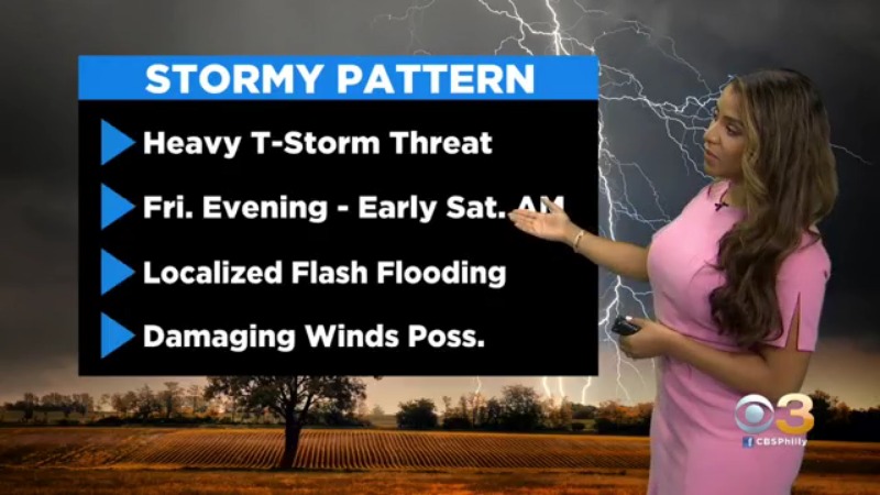
High temperatures will jump back into the low 90s and when you add in the humidity it will likely feel as hot as 100-105 throughout Friday afternoon. The chance for downpours will increase during the afternoon. A slow front will traverse the area leading to scattered heavy storms. Some of these storms could turn strong to severe prompting damaging wind gusts.
A Code Orange Air Quality Alert is in place Friday, which means the air is unhealthy sensitive groups.
Shower and thunderstorm activity is likely to continue tonight and some of the heaviest rain could be possible overnight into Saturday morning.
Over the course of the weekend showers and thunderstorms will be possible on both days, but the higher risk will be on Saturday.
By Sunday thunderstorms will become more scattered in nature but will still be possible. Highs over the weekend will sit in the low 80s both afternoons.