Philadelphia Weather: Cold Front To Bring Potential For Heavy Downpours, Flooding Across Region
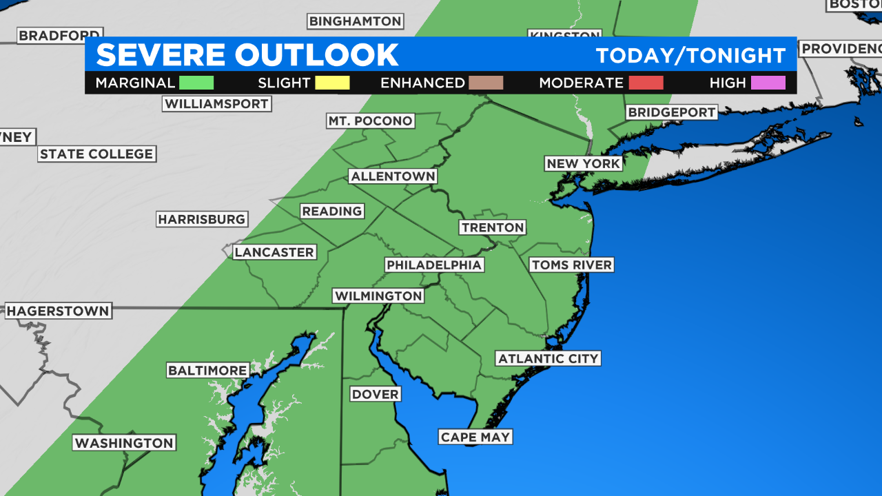
PHILADELPHIA (CBS) - A slow-moving cold front will prompt a marginal risk for severe weather on Thursday. Pockets of moderate to heavy downpours are possible through the afternoon.
Download The New And Improved CBS Philly App!
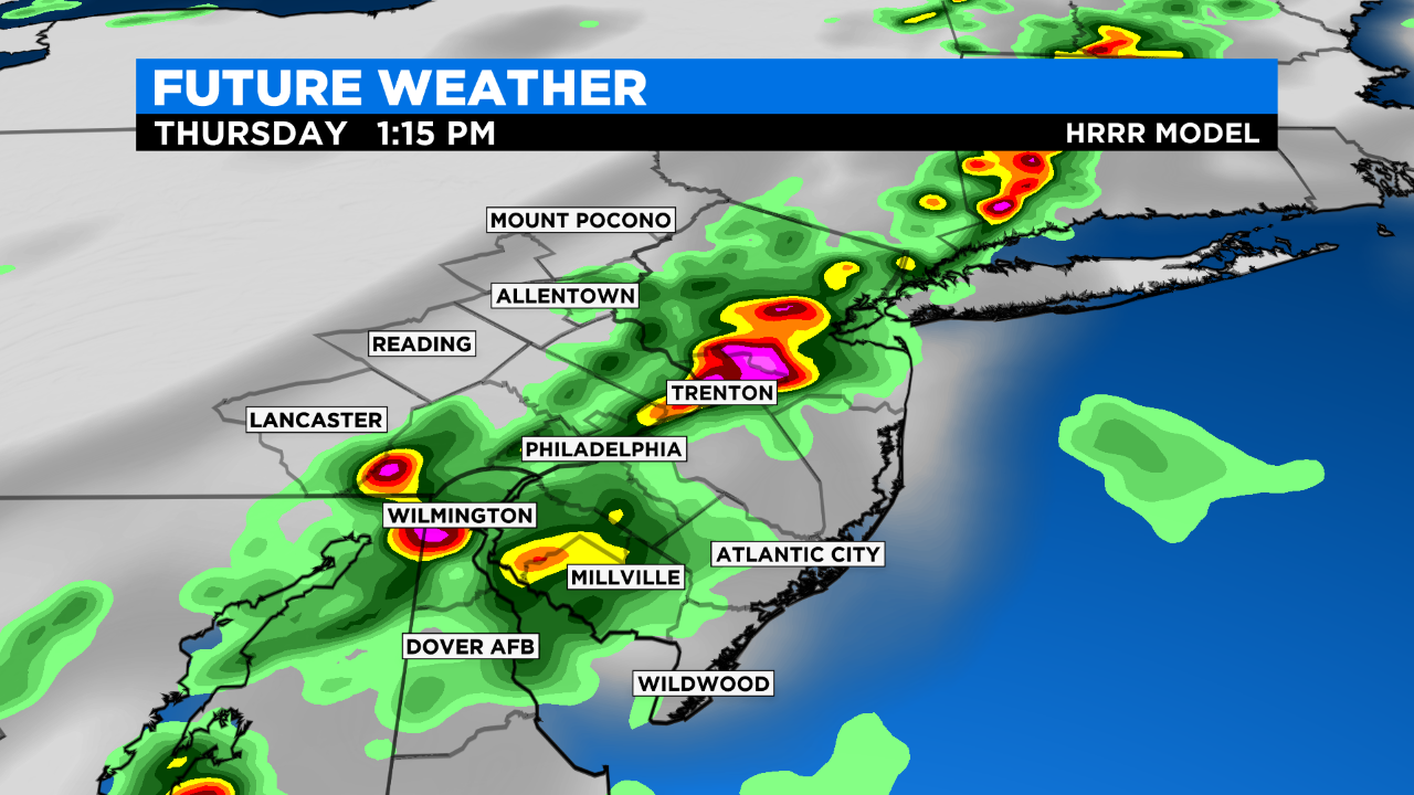
The front will keep the day active, with scattered thunderstorms around. One thing we will be watching for is heavy rain as thunderstorms stay nearly stationary over any given area.
While flooding is possible today, damaging winds are the primary risk. Hail is also possible.
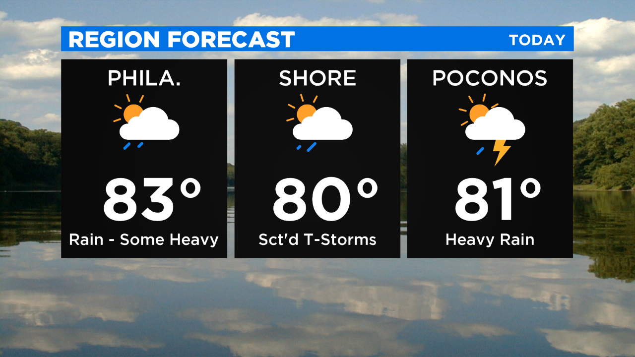
Temperatures won't be quite as hot and humidity won't be as high. However, with enough moisture in the atmosphere, rain can be quite heavy at times.
Good News! Today won't be as hot, humidity won't be as high either, BUT storms are on tap for us throughout the day. #PhillyWeather @CBSPhilly
— Llarisa Abreu (@LlarisaAbreu) June 11, 2020
Storms are expected to fire up closer to noon across Philadelphia. The focus will later shift to the Jersey Shore during the late afternoon.
It will be briefly quieter and more comfortable with seasonable temperatures and lower humidity over the weekend before more unsettled and cooler weather takes over next week.
A parade of boundaries moving through the area will allow for a chance of showers or a few thunderstorms, basically from Monday through most of next week.