Philadelphia Weather: Coastal Storm Will Bring Wind, Flooding Concerns To Shore And Snow To Poconos
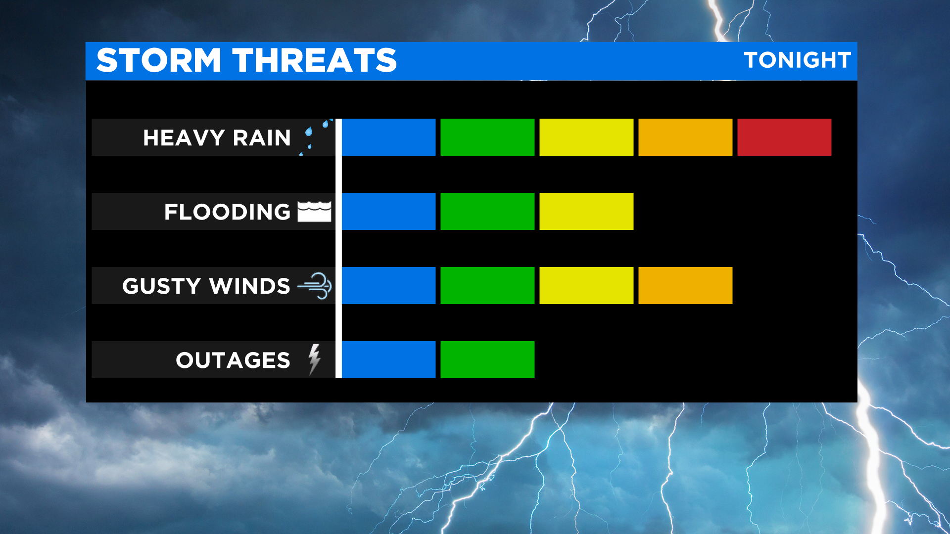
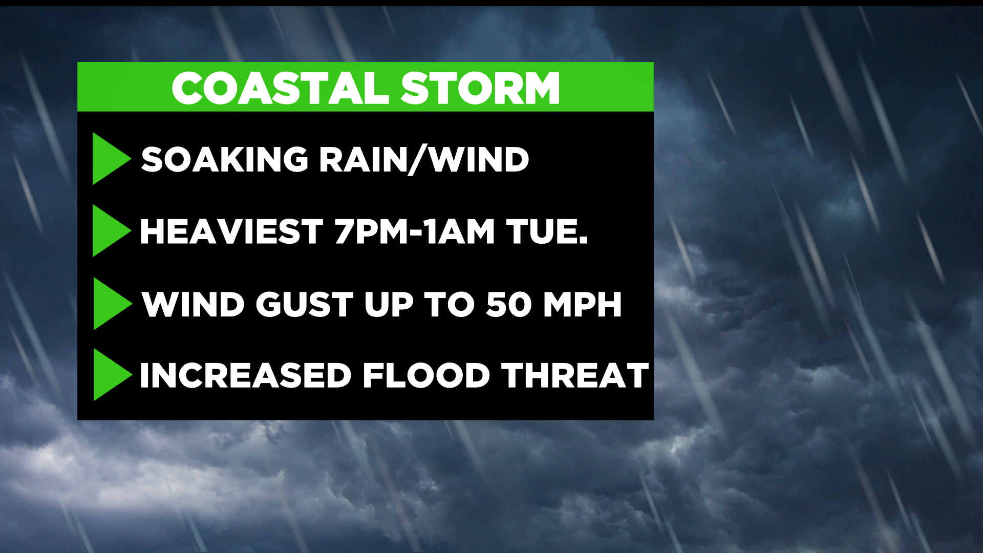
PHILADELPHIA (CBS) - Record cold gripped the region Monday morning, shattering and tying record cold morning lows from the Lehigh Valley to Atlantic City. Now our attention turns to a coastal storm marching up the Mid-Atlantic. The storm is likely to bring periods of heavy rain, strong winds, and wet snow across the southern Poconos.
Rain will arrive after 2 p.m. filling into the I-95 corridor closer to 4 p.m. Rain will pick up in intensity and coverage through the evening rush.
Sixers fans should have a plan when exiting the game, as rain will be heavy at that time.
As the coastal low approaches the region, winds will turn gusty. A wind advisory has been issued for the Shore, that's where wind gusts could peak up to 50 MPH.
Flood concerns are also possible during high tide for all areas adjacent to a body of water. The period of unsettled weather will continue overnight.
Some snow accumulation is also possible for Southern Poconos. That's where a wintry mix is possible. Snow accumulations could range between 2-4 inches. A general 1-2 inches of rain is likely and could lead to ponding on the roads. Rain should gradually taper off from South to North, ending shortly after 4 a.m. on Tuesday.