Tracking Ida: Rare Tornado Warnings And Historic Rainfall Devastate Tri-State
By Giorgio Panetta, CBS2 Chief Meteorologist/Weather Producer
The remnants of Ida have devastated the area. Like we said yesterday, multiple layers of atmospheric phenomena fused into a dangerous storm with an unlimited moisture feed, the Atlantic Ocean.
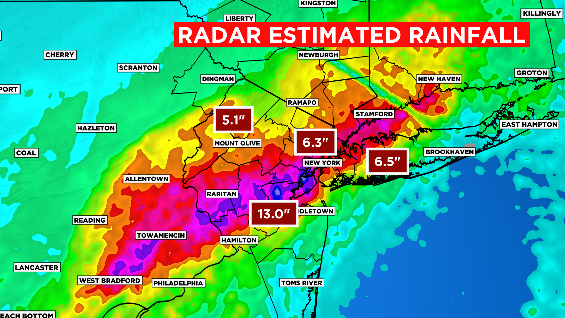
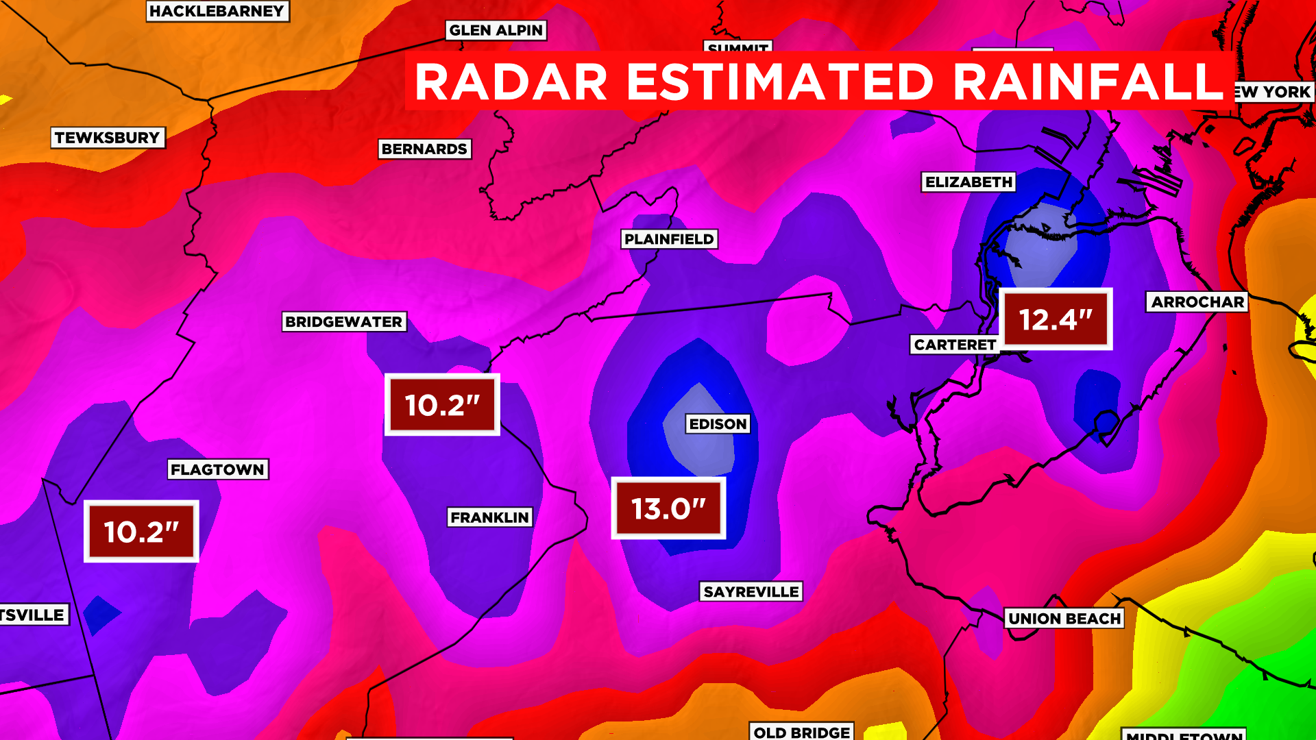
Therefore, we got a torrential rain basically across the 1-95 corridor. Potentially 13 inches around Edison, New Jersey.
A very rare tornado warning was issued in Manhattan and the north shore of Long Island.
Southern New Jersey saw tornados touch down with extreme damage.
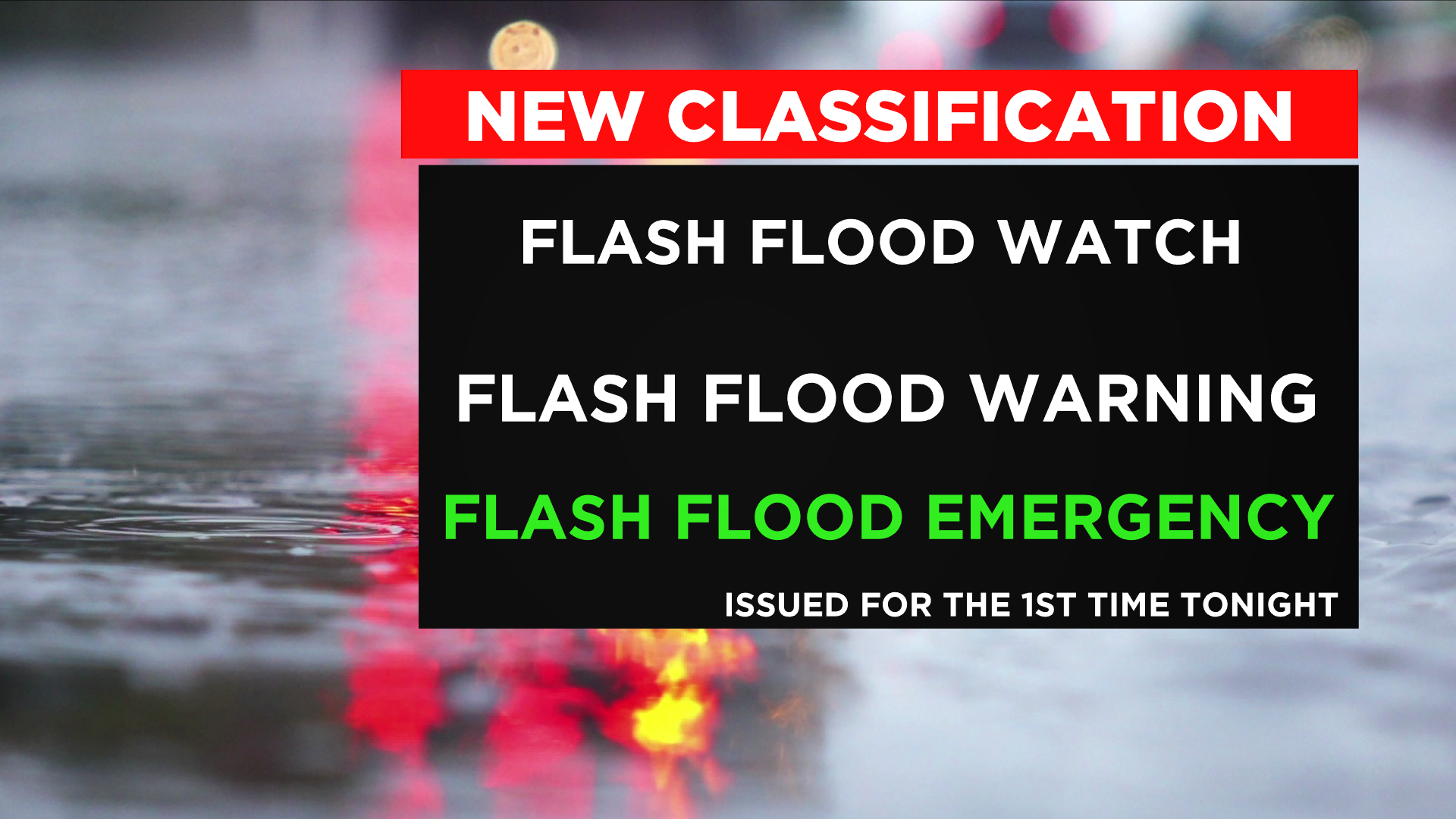
All of northern New Jersey, Long Island and the Hudson Valley are still under a flash flood warning until the early morning hours.
Basically, the entire area is flooded. Do not travel overnight if unnecessary. Flash flood warnings are still in effect until 3 a.m. for New York City.
Rainfall rates came down at 3 to 5 inches per hour.
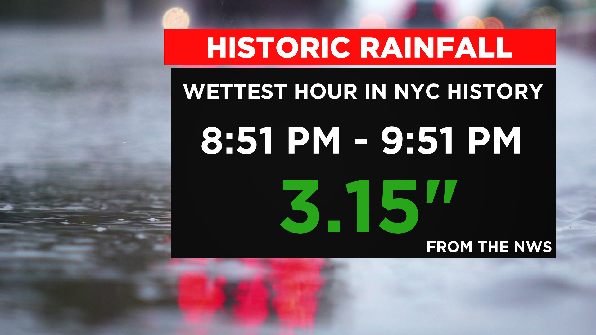
New York City received 3.15 inches in one hour from 8:51 to 9:51 p.m. For the day, Central Park received 6.40 inches.
I expect a very rough scene waking up tomorrow. Classic post storm sunshine will reveal the extent of the severity and damage.
Again, we experienced the scary dynamics normally reserved for the Midwest, combined with the remnants of a CAT 4 Hurricane plus the ocean's moisture. No one was really spared in our area. I have never seen weather expand and flood so quickly, for so long.