New York Weather: CBS2's 9/23 Thursday Afternoon Forecast
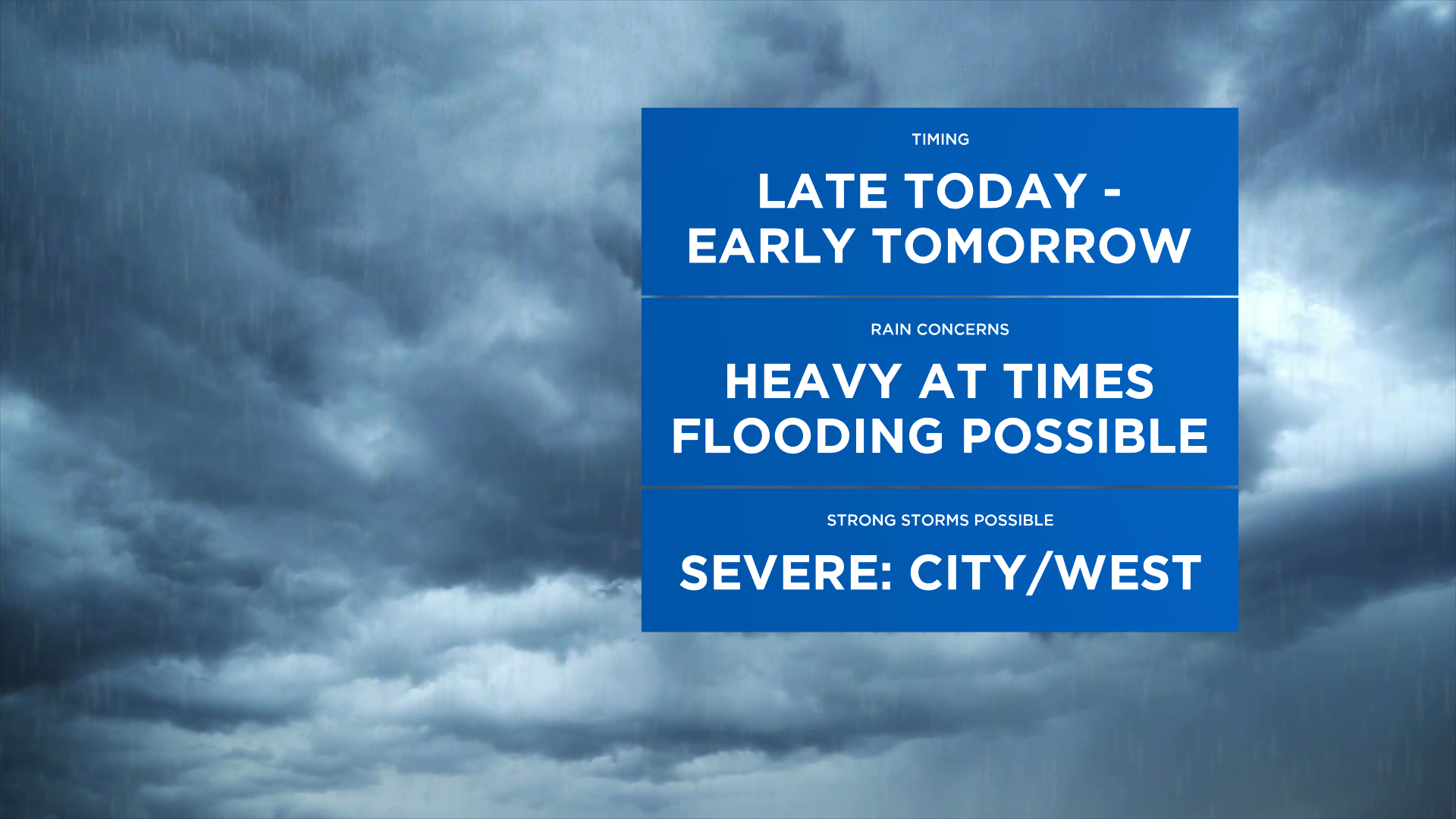
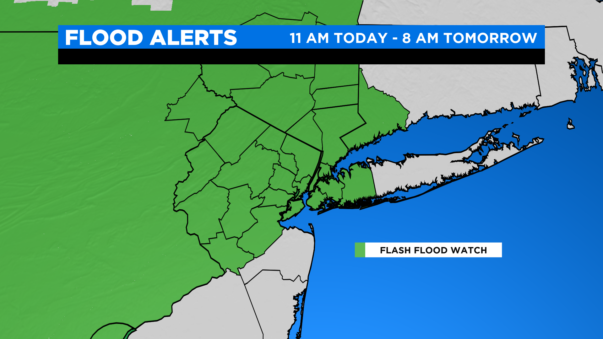
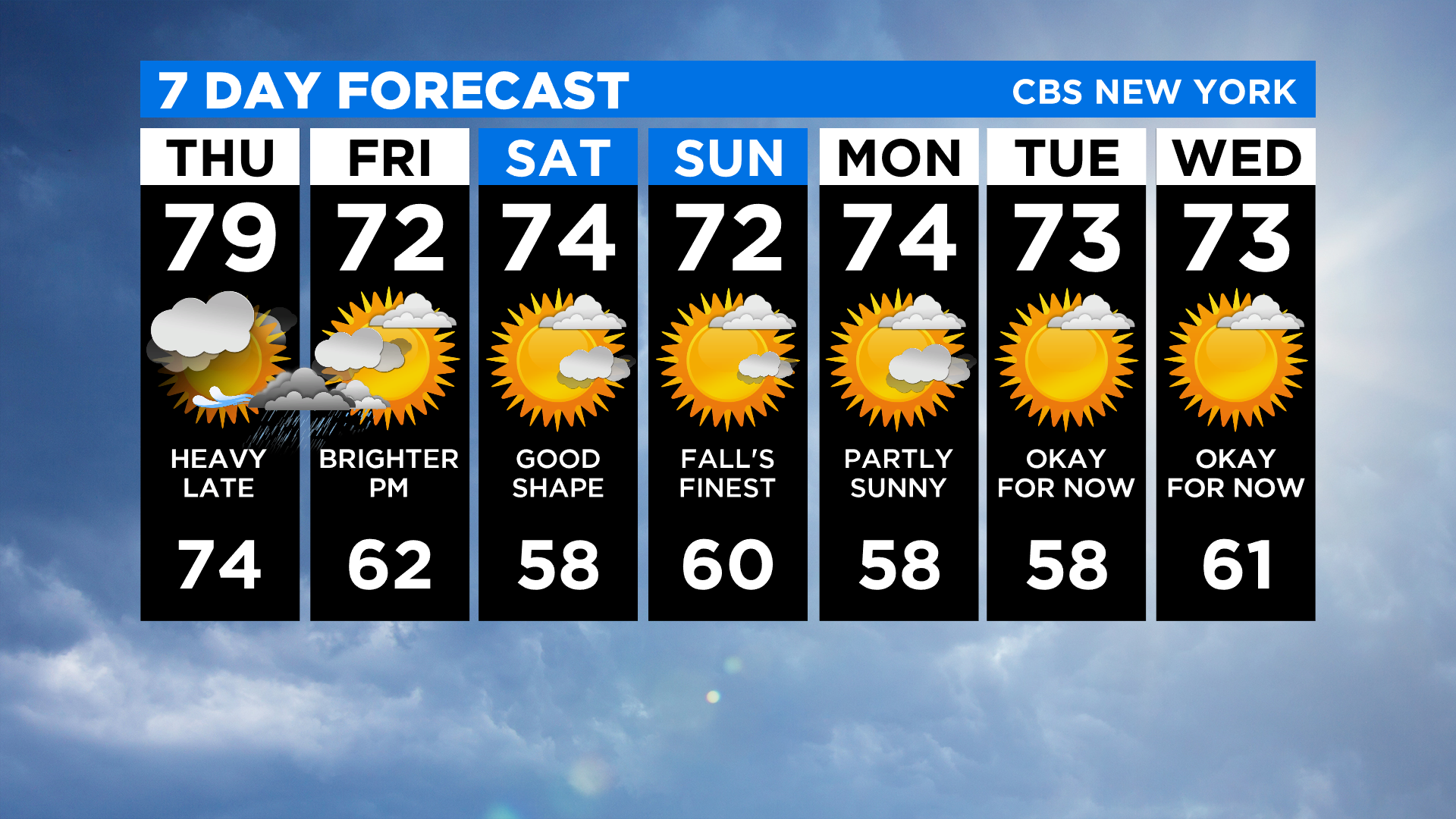
Today we're expecting sct'd showers, humid conditions and highs in the upper 70s. Then we'll have to keep an eye on a slow moving front that will work its way through our area this afternoon -- and mainly late this afternoon into the evening in the city -- into Friday morning. Periods of heavy rainfall is expected with the heaviest rainfall around/west/N&W of the city. That said, a flash flood watch will go into effect later today for much of the area at 4PM (11 AM far west/southwest) and remain in effect until 8 AM tomorrow.
In addition to this, there's a marginal risk for severe t'storms this afternoon through early tomorrow morning. The main concerns with these storms will be locally damaging winds and the potential for an isolated tornado west of the city.
Showers exit the city tomorrow morning and gradually push east the remainder of the day... a strong or even severe t'storm can't be ruled out across Long Island. It will be cooler and less humid, too, with highs in the low 70s.
Saturday and Sunday will be mostly sunny to partly cloudy with highs around normal (low to mid 70s).