7/17 CBS2 Friday Evening Weather Headlines
By Mark McIntyre, CBS2 Meteorologist/Weather Producer
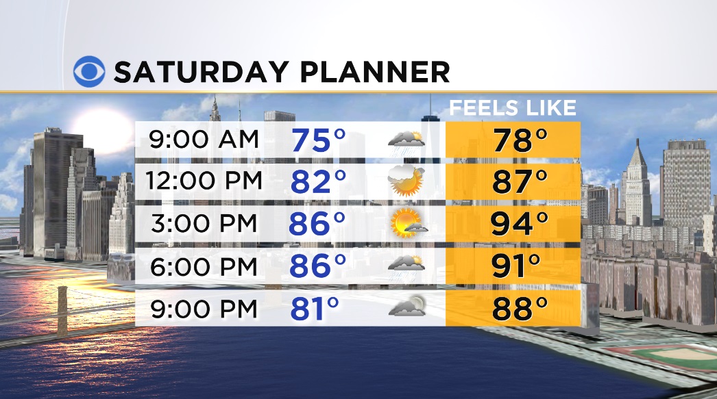
Good evening, everybody! As promised we had a wonderful finish to the week with plenty of sunshine and comfortably warm temps in the upper 70s/low 80s. It's gonna be a mild night with increasing clouds and lows dropping into the mid/upper 60s around town. A warm front moving through the region will bring a chance for showers and thunderstorms overnight into early tomorrow. Expect some breaks of sun tomorrow afternoon after the front pulls through, but there could be some pop-up storms in the afternoon with the heat and humidity. Looks like variable cloudiness with a high of 86...Feelin' more like the mid 90s with the humidity!
Sunday will be an even hotter day with temps soaring into the low 90s, even at a few coastal locations! Interior portions of NJ should have no problem getting to 95, and with dew points in the low/mid 70s, it'll actually feel more like 100-105! Make sure that if you are gonna be outside, that you drink plenty of water and take it easy. Chance for storms returns Sunday night into Monday with hot & humid conditions continuing.
Check back in for the latest, and have a great weekend!