2/14 CBS2 Saturday Afternoon Weather Headlines
By Matt DeLucia
CBS2 Meteorologist/Weather Producer
Happy Valentine's Day!
Hope you have that winter gear ready... you're definitely going to need it around here for the foreseeable future!
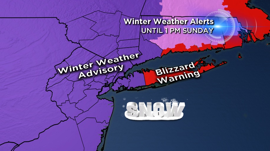
A blizzard warning goes into effect for Suffolk County at 6 p.m. this evening with winter weather advisories for everyone else.
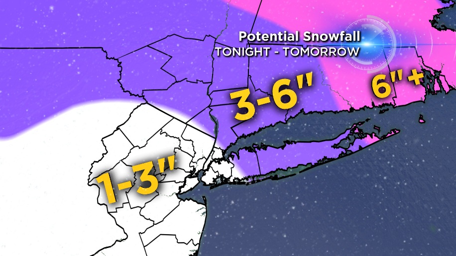
Snow totals around the Tri-State area will not be tremendous, as the BIG snowfall will once again be up in New England, including Boston... again! However, the snow combined with very high winds will cause greatly reduced visibilities at times.
High wind warnings and advisories are also in effect for late tonight through tomorrow. Winds will gust to 50-60 mph at times and some power outages are certainly possible.
As for snow, it will continue to develop this afternoon from west to east. Snow will continue overnight, heavy at times. It looks like there will be a few lulls in the action depending on your location.
The good news is, the snow quickly moves out tomorrow morning and we'll see gradual clearing for Sunday. The strong winds will continue though! With a high of only 18 in New York City for Sunday and strong NW winds 30-40 mph, it will feel well below zero for much of the day. BRRRRRRR!
Sunday night into Monday looks to bring some of the coldest temps we've seen in a while. Going for a low of 3 in the city with sub-zero temps in the suburbs. It's very likely some daily low temp records will be broken. Mostly sunny skies on Monday, but staying frigid with highs only in upper teens and low 20s.
Check back in tonight for the latest on the snow, wind and brutal cold!