Minnesota Weather: Cold Snap Strikes Thursday, Snow Moves In Friday
MINNEAPOLIS (WCCO) -- The Twin Cities find themselves in a cold snap once again Thursday.
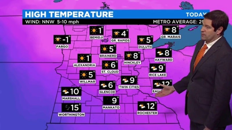
In fact, all of Minnesota was waking up to subzero feels-like temperatures. The upper half of the state will be under a wind chill advisory through the morning.
Most of the state will only see single-digit highs, with the Twin Cities peaking at about 9 degrees. The average for this time of year in the metro is 29, WCCO Meteorologist Riley O'Connor said.
Freezing temps aside, the day will be mostly sunny and dry.
Snow showers will move in Friday morning, likely hitting the Twin Cities just after lunch. Some freezing rain or sleet could materialize, too.
The metro will hit its high of 32 early in the day, and temperatures will fall steadily after that.
Saturday will be a bit colder, with highs in the 20s, but on Sunday, the Twin Cities could hit 40 degrees.