Tropical Trouble In Both Basins
Find Eric Fisher on Twitter and Facebook
October is not a time for the tropics to go to bed. Some of the largest hurricanes and most destructive storms have formed in the 10th month, and it's just as close to the peak of hurricane season as mid-August! On cue, in large part due to a favorable MJO (Madden-Julian Oscillation) phase traveling across the Atlantic, the tropics are alive this week. Fay brought significant impact to Bermuda over the weekend, which now eyes are more substantial threat from Hurricane Gonzalo.
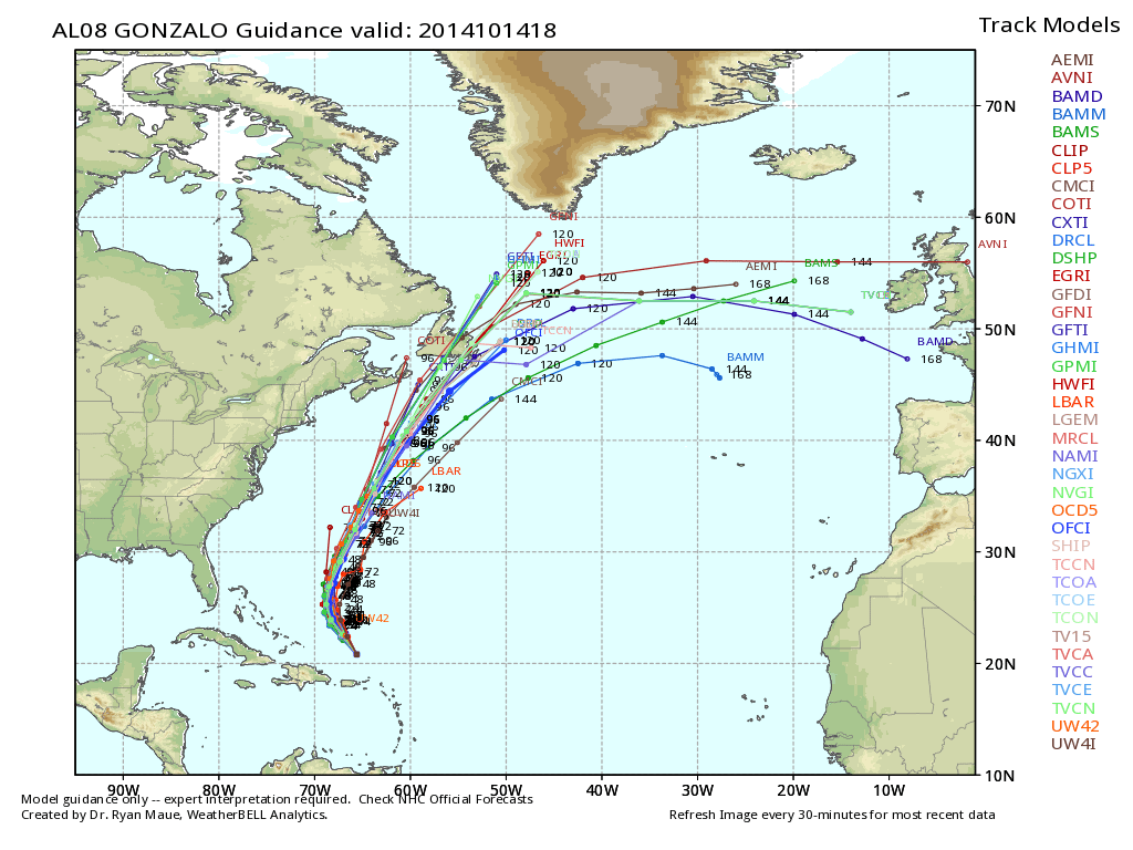
Atlantic Is Alive - Major Threat to Bermuda
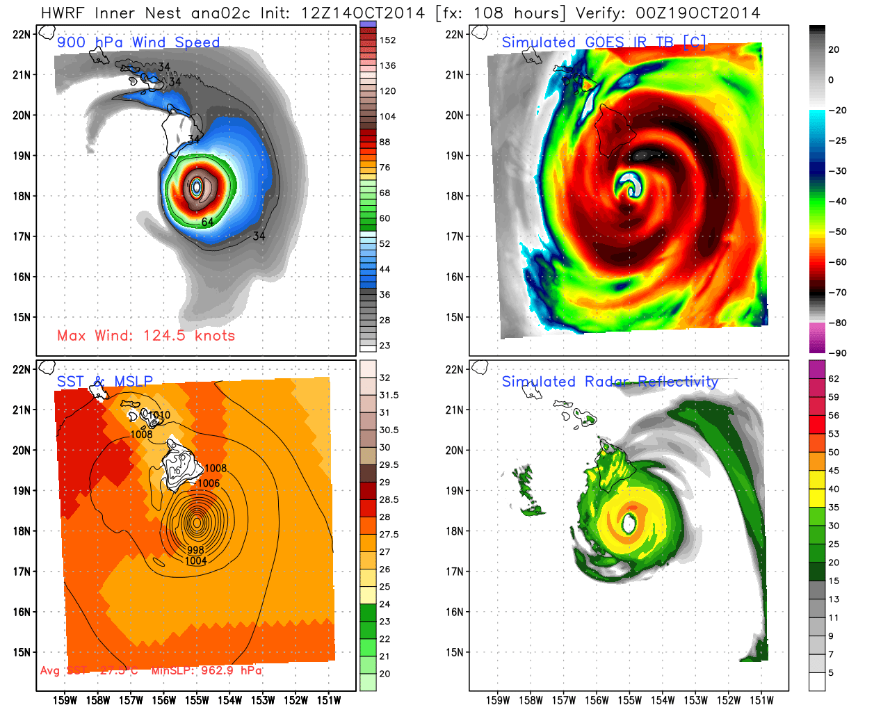
Gonzalo is the 2nd MAJOR (Cat 3 or higher) hurricane to form in the Atlantic basin this year. Puerto Rico was spared a hit as the storm moved just off to the northeast, but all signs are that Bermuda could take a direct, or near direct, strike by Friday. Gonzalo looks ripe to strengthen over the next 24 hours, likely becoming a Category 4 beast of a storm. If it can reach max sustained winds of 140mph, it will be the strongest Atlantic storm to develop since Ophelia in October of 2011. At this point that potential looks well within reach.
Anyone with interests related to Bermuda should be making plans now. Current indications are that the storm will pass just west of the island, which is actually the worst case scenario. This would bring the strongest winds with the hurricane directly over the island. Not only that, but huge surf will be roaring ashore starting on Wednesday and building until the storm moves by on Friday. Bottom line is that this is a dangerous storm that should be taken seriously on Bermuda. It'll also bring some large 8'+ swell just offshore here in New England. Anyone planning a fishing trip should plan on some high seas!
Another Hawaii Hit?
Flip to the Pacific, and there's a storm you may not have heard as much about. Ana is steadily plowing its way west. If you go to the traditional NHC site, you won't find any info about it. This one is under the jurisdiction of the Central Pacific Hurricane Center because it developed west of the E-Pac Hurricane Center's territory. While the exact tracks differ from model to model, it's looking more likely that this will move right toward the Big Island of Hawaii. Seeing hurricane warnings posted for the Big Island twice in one year would be extremely unusual, if not unprecedented (historical info doesn't go back very far for Hawaii). The timing on Ana brings the storm near the Big Island by late Saturday or early Sunday. Another one to watch if your plans take you to paradise on/after this weekend!
Not Tropical, But Impressive!
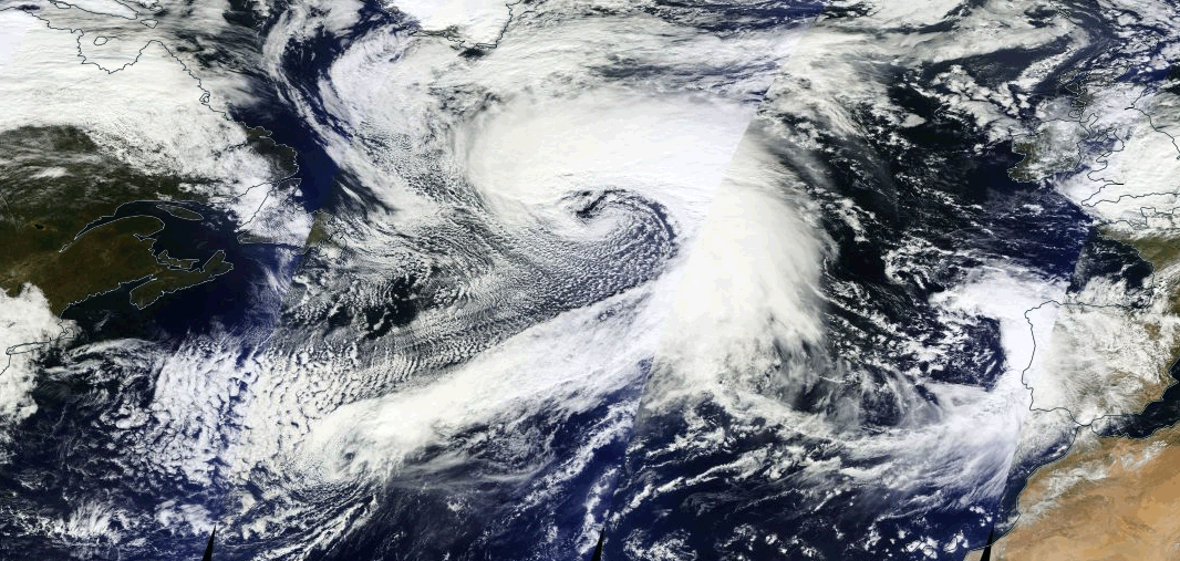
While compact storms can certainly pack a powerful punch, the extra-tropical cyclone roaring across the North Atlantic dwarfs Gonzalo and Ana in size and reach. Sunday into Monday - this monster 'bombed out' dropping an incredible 46mb in 24 hours. We saw a number of these during the course of last winter as storm after storm blew up off the East Coast. Time will tell if this is the first of many heading into the depths of autumn and winter. Below are some amazing images of this one, which makes Gonzalo look like a fly on a rhino's back!
North Atlantic cyclone as seen from space on Tuesday.
Awesome animation of this storm forming from NOAA's Ocean Prediction Center:
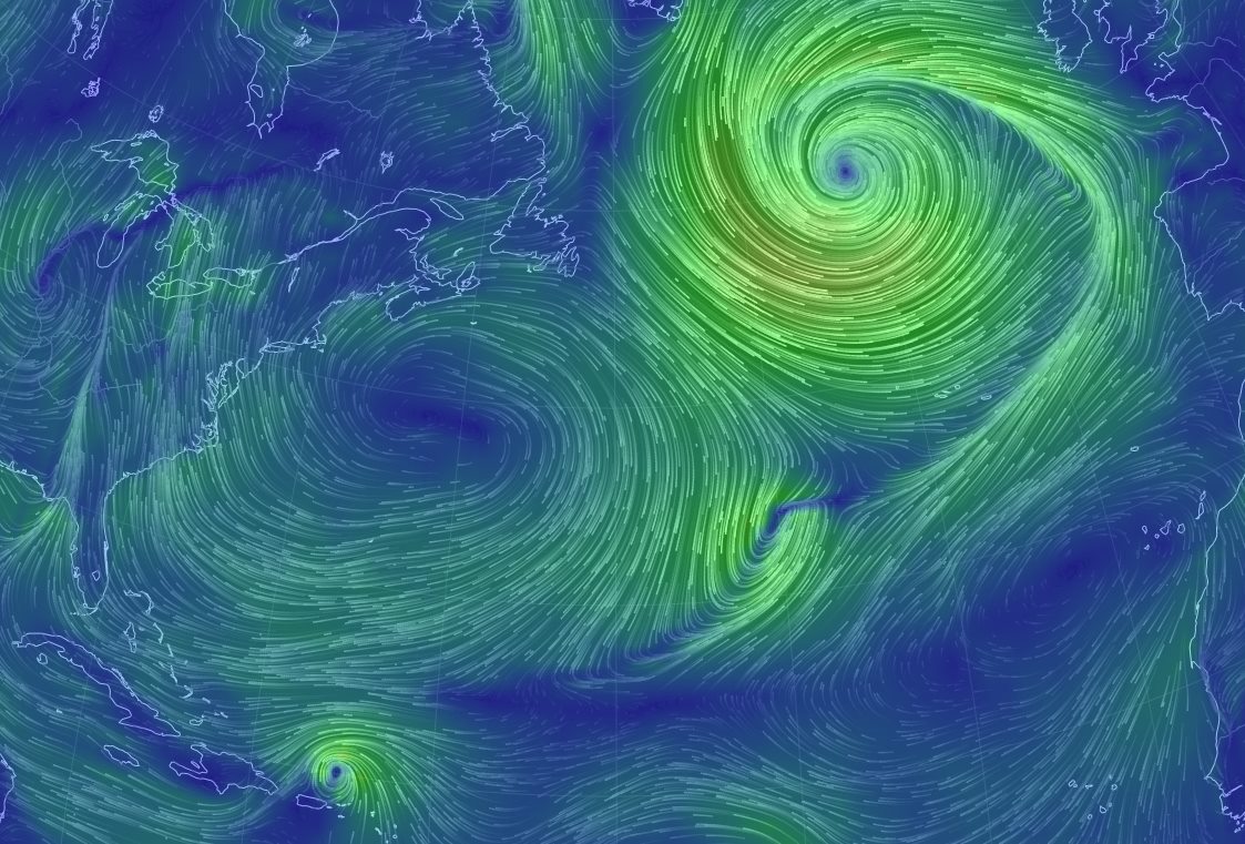
From the Earth Wind Map...this visualization of surface winds over the Atlantic shows the scope of this storm vs everything else around it. You can barely even see Gonzalo at the bottom of the image! This cyclone is essentially controlling all wind in the North Atlantic between North America and Europe.