Torrential Rain Wednesday; Flood Watch Posted
A flood watch has been posted for parts of the Bay State, effective this evening until Thursday morning. Scattered showers are in the forecast for today, along with another day of unseasonably warm and humid conditions by late September standards. Our cool down begins tomorrow as a front approaches from the west. Along the front, moisture from the southeast U.S. will organize into areas of tropical downpours, impacting our Wednesday morning commute.
Torrential rain will make for a really tough drive into work; expect reduced visibility, lots of ponding of water on the roads and localized flooding. The evening ride won't be as bad although there will be some pocket of light rain around. Rainfall totals will top out between 1-3" for many communities with locally higher amounts possible.
This front stalls off the coast on Thursday. So while we may get a brief lull in the action during the morning, another wave of low pressure will bring more rain in eastern MA Thursday afternoon and evening…continuing at times into Friday.
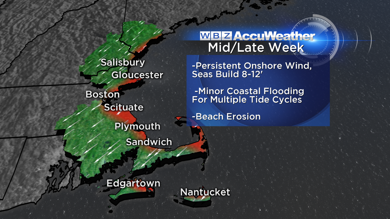
Just a quick update on the coastal flood threat–
Astronomical high tides and a prolonged onshore wind will kick up the seas and batter our coastline. Wind gusts 30-40 mph are likely, with minor coastal flooding for multiple high tide cycles starting tomorrow afternoon. The typical shore roads may flood…if you live in these areas, you know the drill. Coastal residents in Plum Island, Revere, Scituate, Plymouth and Sandwich are the biggest focus; beach erosion is likely along north and northeast facing beaches.
After that, Tropical Storm Joaquin comes into play. Forecast certainty is low this far out, but what I will say is that Joaquin has the potential to bring us several more inches of rain this weekend. Whether wind is a primary concern has yet to be seen.
Keep in tuned to WBZ all week and we'll have updates here on the blog too.
-Danielle