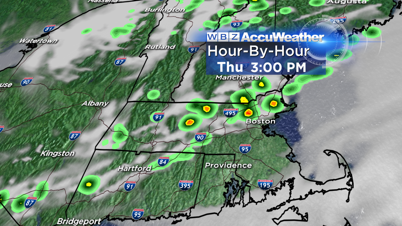
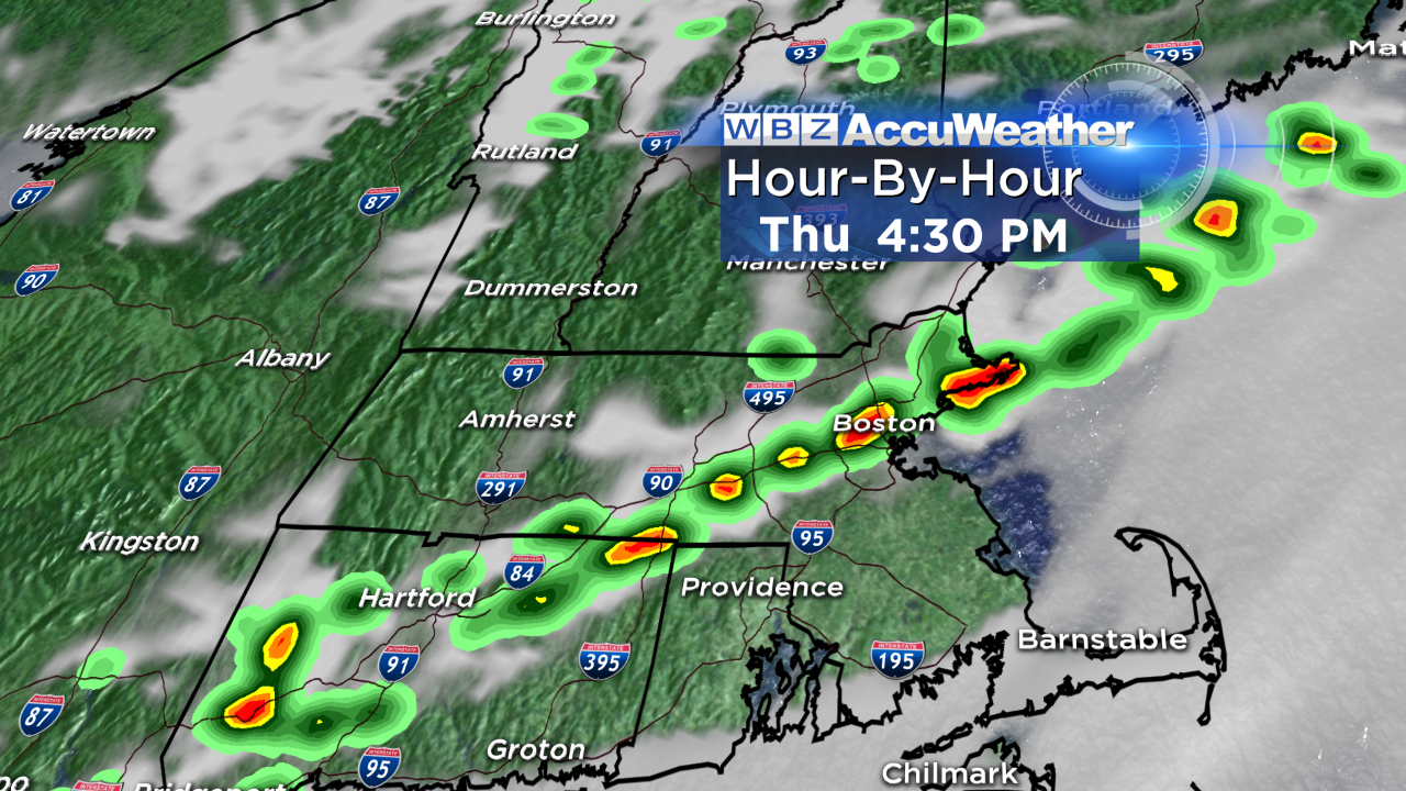
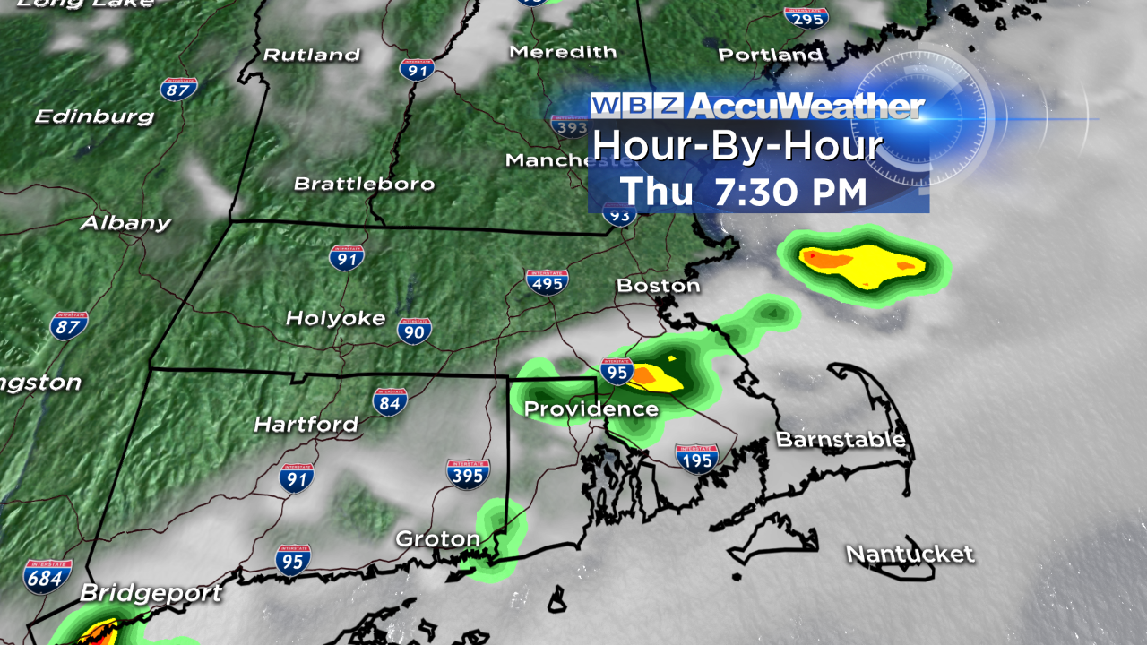
Threat for Severe Storms Thursday
Strong to severe storms rumbled across parts of western and northern New England yesterday, but weakened rapidly as they came into central/eastern MA last evening. Today, a cold front will trigger another round of storms…but this time around, many of us will have to be on guard.
The storms will be scattered in nature, so in other words, not everyone is going to see one. If you have outdoor activities this afternoon or evening, I wouldn't cancel them – but you certainly need a backup plan to seek shelter indoors should a storm head your way.
Our CBS Boston Weather App is an awesome tool to have (I use it often, but especially on days where t'storms are in the forecast); you can check the live radar to see if storms are moving in your direction, watch our video forecast and monitor severe thunderstorm warnings. Oh, and it's free!
Timing of the thunderstorm risk:
1-6 PM (north & west of Boston)
3-7 PM (metrowest, North Shore)
4-8 PM (Southeast MA)
A few storms could become damaging – the biggest risk of severe storms is north & west of Boston. Strong wind gusts, hail, torrential downpours and lightning could accompany any storms that develop.
Once the sun sets, storms will come to an end and skies will partially clear overnight. Tomorrow looks like a beautiful end to the week – less humid, plenty of sun and not as hot. We'll see highs around 80 inland, 70 at the coast with an onshore wind. Saturday looks like the pick of the weekend since Sunday will feature numerous showers and storms ( we do need the rain!).
I'll see you at 4:30 AM tomorrow for WBZ This Morning :)
-Danielle