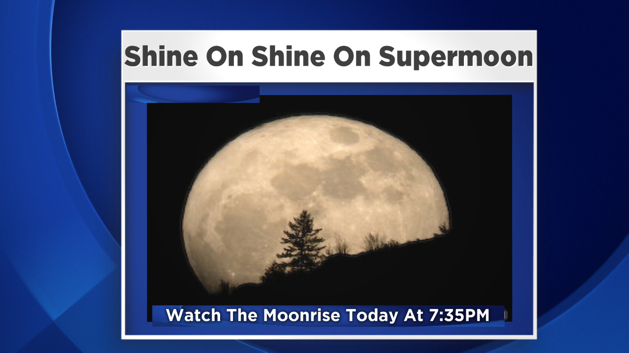
Full moons in the summer are extra special since we can enjoy them outside in comfortably warm air. So we are indeed lucky to have clear nights with little haze this weekend. While the night sky will be bathed in moonshine, this so-called "Supermoon" will really not look that much different from any other moon. There are many unrealistic expectations about this moon. Check out the moon story here. While you enjoy the moon this evening, temperatures will fall back through the 70s and into the 60s by midnight in the suburbs with lower 70s in the city after reaching near 85 away from the ocean today. A soothing sea breeze will stall the temperatures closer to the upper 70s at most beaches this afternoon as ocean has warmed up to the upper 60s to near 70. The onshore breeze maintains the warmer water. Stronger offshore winds later this week will push the warmer surface water farther offshore. Today's high tide occurs at 11:18 am and the Full Sturgeon Moon at its closest approach to Earth this year will especially enhance the overnight high tides closer to and past midnight over the next few nights. Fortunately, there are no coincident ocean storms to result in any coastal flooding.
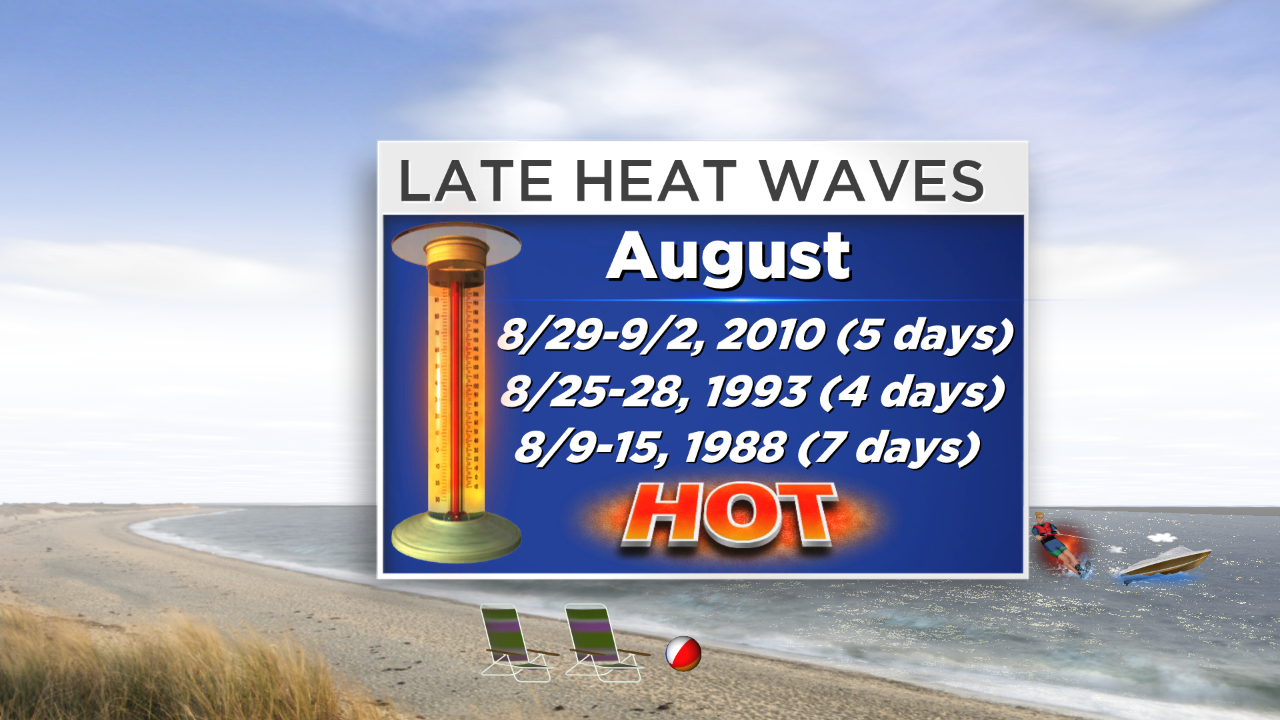
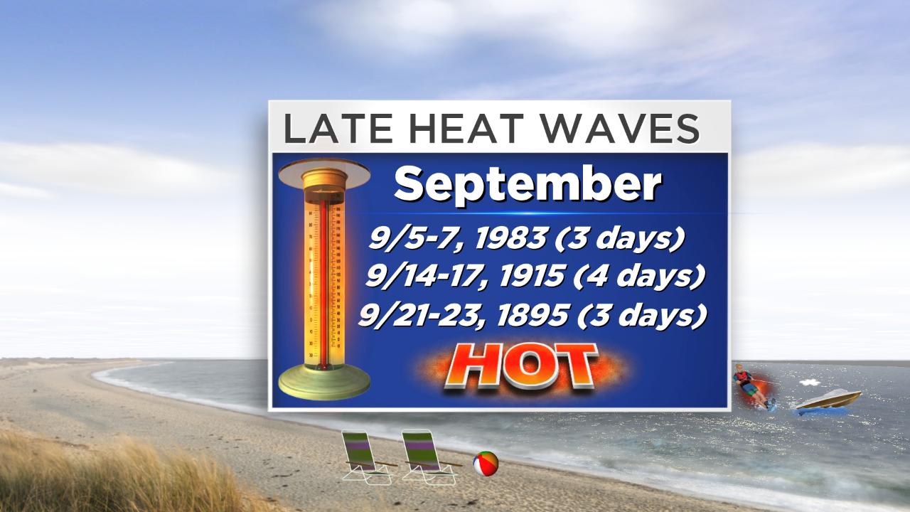
I remain amazed that Boston has not had one heat wave this summer. Is it possible that the city will not have any for the entire summer? I am not certain if that has ever happened. Well, time is running out but heat waves can occur later in August. One of the city's longest heat waves occurred on August 9-15 in 1988. The most recent late season heat wave took place 4 years ago over 5 days from August 29 through September 2. Presently, all indications point to no heat waves this week but some longer range clues speculatively hint at a day or two of hot weather around the 19th of the month and perhaps again a week later. Clearly, that is not a high confidence forecast yet. Statistics reveal that Boston has endured only 3 heat waves in September since records began way back in the 1870s. It is more common to have only singular days of 90 degrees or higher. After no 90-degree days last August, the temperature hit 97 on 9/11! Overall, despite only 4 days at 90 or higher this year, the summer has been on the warm side with the mean temperatures all a bit above average starting back in May at +0.8 followed by June at +0.7 then July at +0.7. So far, August is below average at -1.6 degrees.
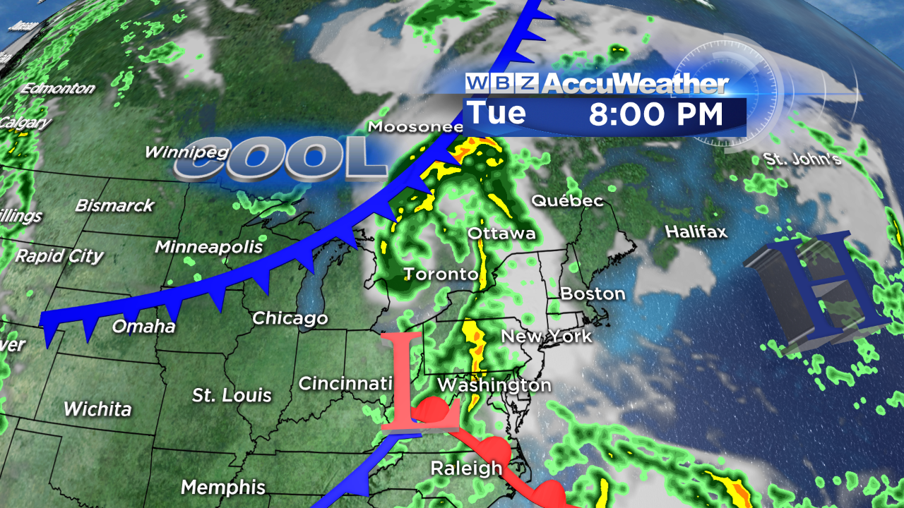
With partly cloudy days in the middle 80s except at coastal locations Monday and Tuesday, it will be cooler the rest of the week. Temperatures in the lower 70s on Wednesday will rise only to the middle 70s on Thursday, Friday and Saturday! Other than an isolated shower possible tomorrow afternoon, more widespread beneficial rain and potential boomers which may be severe in places is expected on Wednesday. That is great news for the farmers as the crops in several communities need some rain badly. An anomalous low pressure system will track from PA into southern New England on that day then spiral into northern New England on Thursday causing scattered showers down here and lots of showers up north. Most of the showers will be confined to the mountains of western and northern New England Friday and Saturday as the storm slowly moves out of the Northeast. There will be some brisk westerly winds on the back side of that feature to make it feel even cooler.
The annual Perseid Meteor Showers peak the middle of this week and it looks like the weather will not be cooperative for us to see them. You may be able to spot some of these rapidly moving shooting stars in the next couple of nights before the clouds and rain enter the region but the bright moonlight will also spoil the show for many of the stars which are faint.
You can watch the weathercasts of Danielle Niles on WBZ New this morning through 9 o'clock and I will deliver the next weathercast at 11 o'clock this evening.
Enjoy the rest of this beautiful weekend.
Read more
More from CBS News
We and our partners use cookies to understand how you use our site, improve your experience and serve you personalized content and advertising. Read about how we use cookies in our cookie policy and how you can control them by clicking Manage Settings. By continuing to use this site, you accept these cookies.