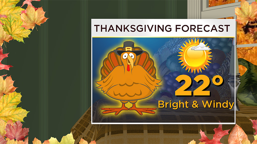
Thanksgiving Weather Forecast: It Might Feel A Lot Like January
BOSTON (CBS) - You think the last few days have been cold? Wait till you see how cold it COULD be on Thanksgiving Day!
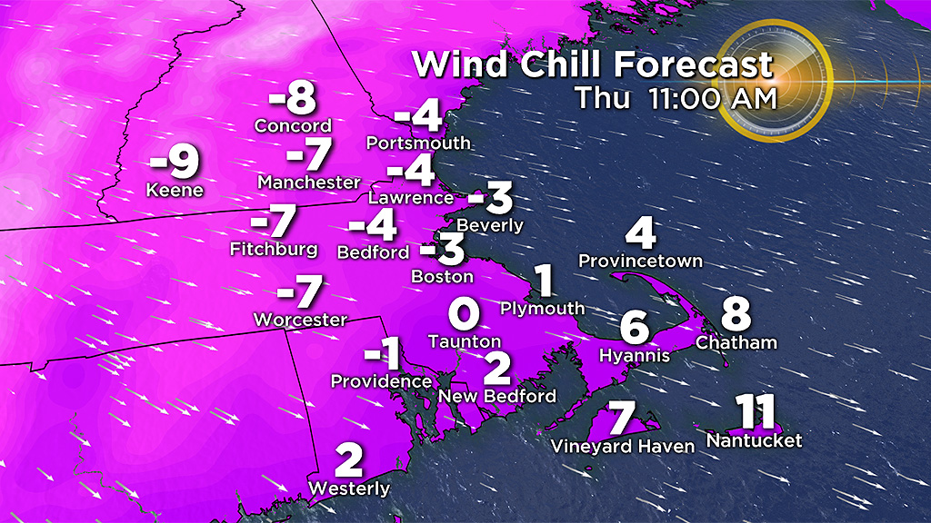
A couple days ago when we were awaiting the arrival of snow, the temperatures were mostly in the upper 20's to lower 30's all day. The potential exists for a nasty arctic blast to create temperatures only in the lower 20's around Boston on the holiday! Add in the gales and you get wind-chilled air feeling more like zero or a bit below Thanksgiving morning for all of the turkey trots and high school football games! Brrrrrrr!
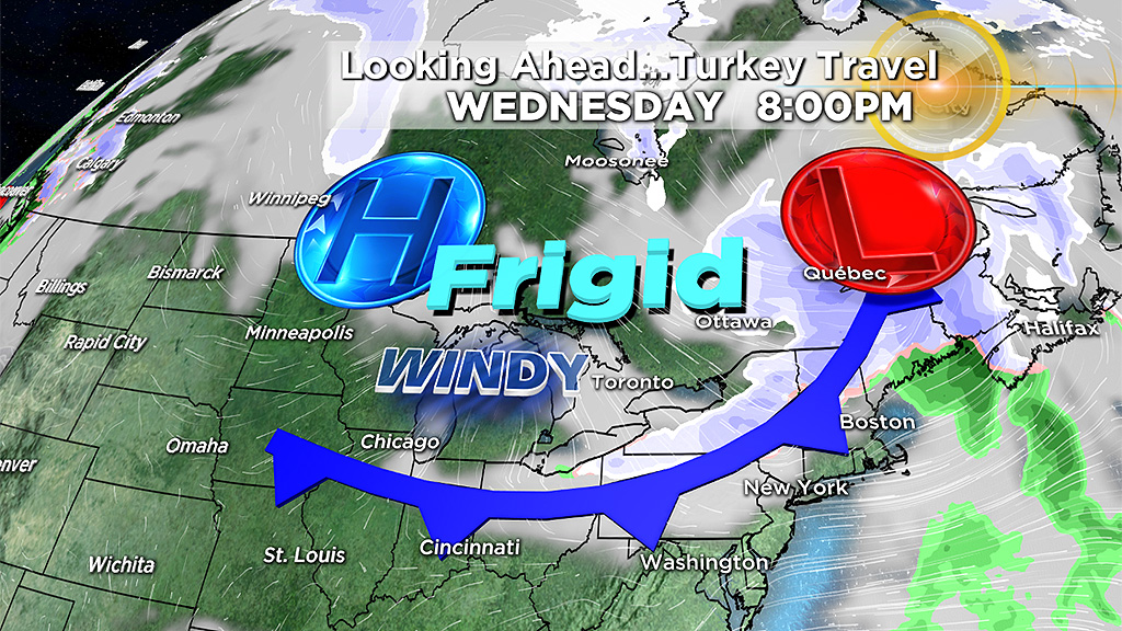
While it is a bit premature to be highly confident about this evolving scenario, it looks reasonable that a potent impulse plunges out of central Canada and hauls down a chunk of arctic chill into the Northeast. It will be introduced by a sharp cold front which may produce some snow showers and possible snow squalls Wednesday evening.
It will be a fast-moving punch so the most harsh weather will be Thanksgiving Day with less wind but still very cold starting out around 8-12 degrees Friday morning. Hopefully, the steering currents will change a bit and direct the coldest air across southern Canada but, for now, it looks like a direct hit for us! Subsequent model runs will become more defining about the intensity of the arctic blast.
If the frontal passage timing verifies, it looks like the temperatures may be in the lower to middle 20s just after midnight then fall into the middle to lower teens by dawn and only slightly recover to near 20 or so early in the afternoon!
Boston's record low temperature for Thursday, November 22 is 9 degrees set in 1879. I am not expecting a record minimum temperature in the city but the lowest high temperature (aka mini-max) for that date is 24 degrees set in 1880. So It could be the coldest November 22nd during daylight!
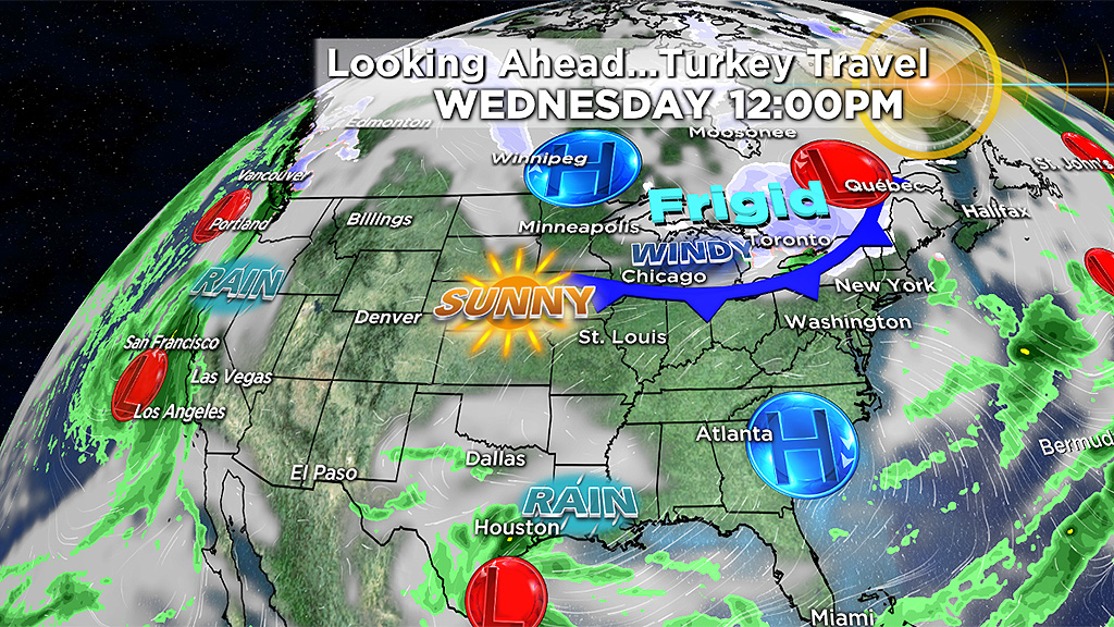
The weather SHOULD be cooperative across most of our nation for the holiday week ahead. No major storms are anticipated from coast-to-coast until Wednesday when a system over the Pacific Ocean will move in to the West Coast especially California creating gusty winds and rain with snow in the higher elevations. Hopefully, it will not produce gully-washer rains resulting in mud slides over the state hit by the horrendous wild fires!
Check important updates on WBZ-TV and CBSBoston.com in the days ahead.