Snow Storm Possible Thursday For Southern New England
BOSTON (CBS) - We seem to be in a one storm per week weather pattern right now. Last week it was Wednesday, this week it is Thursday.
Check: Current Conditions | Interactive Radar | WBZ Weather Blog
Clearly, there are no signs of winter loosening its grip on New England anytime soon.
This week's storm is a bit more complicated than last for a few reasons.
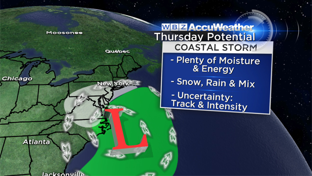
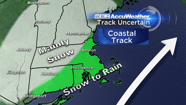
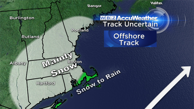
First, the track still remains very uncertain. Weather models today range from a "coast hugger" to a storm track which is much farther east. At this point, it seems that we can rule out one possibility - a miss.
Unfortunately, it does not appear that we will be able to completely avoid this one. Instead, we will just need to work on the finer details including a rain-snow line and how much wind will be involved. Such uncertainty in the forecast is not all that uncommon with still about 72 hours before the storm arrives. I would expect that by Tuesday afternoon a much clearer picture will emerge.
This one is coming right out of the Gulf of Mexico, so there will be no shortage of moisture or energy to work with. In fact, this storm will not be a "New England special," but instead it will leave a wintry path up the entire East Coast. Snow and ice are going to be a major concern from Atlanta, Georgia to Raleigh, North Carolina to Washington DC and into New England.
TIMELINE, ACCUMULATION
The time period of concern for New England would be essentially all day Thursday, perhaps lingering into early Friday.
It will almost certainly begin as snow during Thursday morning, with any amount of luck, just after the morning commute, but that is not locked in stone just yet.
Several inches of heavy, wet snow are likely at the start of this one and then, depending on the ultimate track and intensity of the storm, a mix and change with rain may occur in some areas near the coastline.
Again, it is much too early to project where this rain-snow line will setup and who will stay all snow, but, those areas that do not mix with rain could easily see 6-to-12 inches of snow or more.
WIND CONCERNS
Unlike last week's storm, there will be some wind concerns on Thursday.
As this storm rapidly deepens offshore, strong northeast winds (hence the term nor'easter) are likely to batter our Coastline.
Wind speeds could easily reach 25-to-50 mph or perhaps gust even higher, depending on the track of the storm. Thankfully, tides are not astronomically high this week, so significant coastal flooding would be unlikely.
The best thing to do at this point - stay tuned for updated forecasts.
If your plans have you traveling locally or along the East Coast later this week, there is a very good chance that the weather is going to be a major disruption.
Looking for spring?
Pitchers and catchers will be reporting to Fort Myers later this week to highs in the 70's and 80's. Maybe a little trip to Florida might cure a case of the mid-winter blues.
Follow Terry on Twitter @TerryWBZ
MORE LOCAL NEWS FROM CBS BOSTON