Pockets Of Light Freezing Rain Later Today
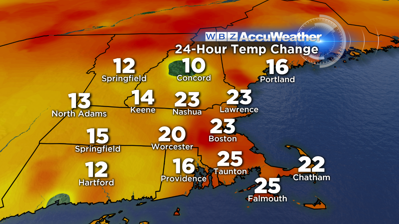
There's a noticeable change in the air this morning…temperatures aren't nearly as cold as they were at this time yesterday. In fact, here's a snapshot of the 24 hour temp change (as of early morning).
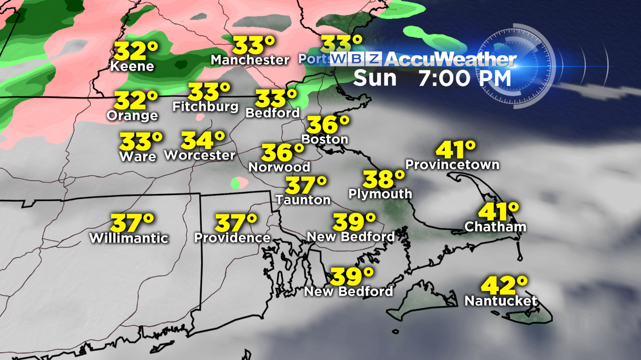
Mild air is on the move but it will take some time today to scour out the cold airmass that's in place. As a warm front approaches from the south, clouds will increase and thicken during the afternoon. While much eastern MA will be in the mid to upper 30s later today, I'm concerned that some communities will still be hovering around that magical 32 degree mark north and west of Boston as a batch of light precipitation moves in. Some pockets of freezing rain will be possible along and outside of 128, with the best chance outside of 495 through central MA and southwest NH. There won't be much more than a trace to a few hundredths of an inch of ice that accumulates, but that's all it takes to create slippery spots on the roads. Use caution if you're traveling late this afternoon & evening in these areas.
Showers will turn to steadier areas of rain overnight with some heavier elements for rush hour tomorrow – so leave some extra time for the morning commute. Temperatures will continue to rise into the low 50s by tomorrow morning! This thaw won't last long…bitterly cold air comes back on Monday night (watch for black ice) & wind chill values will be either side of zero by Tuesday morning.
-Danielle