Ocean Storm Stays Offshore
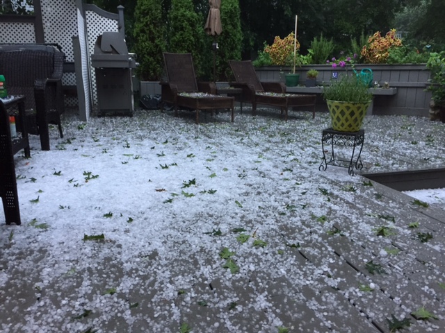
We've made it to the weekend! And what a week it has been. Some communities are still cleaning up from Tuesday's severe weather outbreak. I'm still sifting through emails – mostly of incredible hail pictures and videos from you. I want to take a moment to thank all of you who send in reports/emails/observations etc…it is greatly appreciated, especially during stormy weather. Keep em' coming!
Hail Tuesday afternoon in Wellesley, Courtesy: Carl
Our weather has quieted down considerably now as high pressure builds in to our north. This will promote an onshore flow the next several days meaning temperatures will be coolest at the coast through the weekend (low to mid 70s). In fact, there's no real deep heat in the forecast for the foreseeable future.
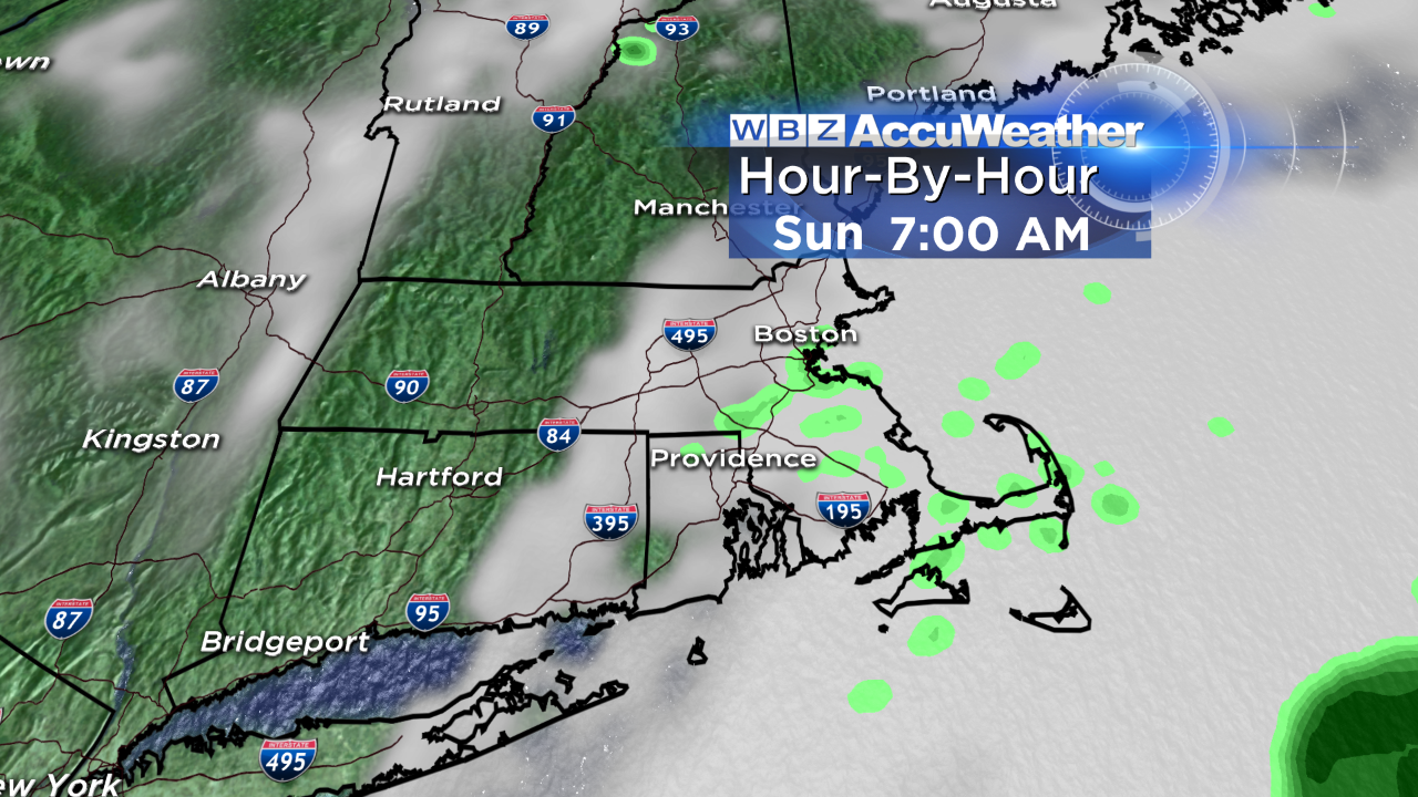
The persistent wind off the ocean will likely stir up more clouds on Sunday, especially at the shore. For that reason, I'm thinking Saturday is the pick of the weekend. Thankfully (unless you're hoping for rain for the lawns/gardens I guess?) the weekend looks mostly dry; the greatest risk for a few showers is the South Shore to Cape Cod on Sunday.
The above map made be slightly overdone in terms of moisture, but you get the idea. More clouds, a few showers possible.
Otherwise, our humidity stays in check for several days too – muggy air doesn't return until Tuesday. With that will come a threat for thunderstorms, slow-moving ones at that, so we'll have to watch for some localized flood potential Tuesday afternoon.
Enjoy your weekend - I'll see you Monday morning for WBZ This Morning starting at 4:30 AM!
-Danielle