Severe Thunderstorms Could Bring Damaging Winds, Isolated Tornado To Boston Area
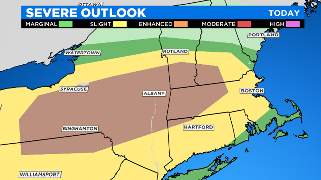
BOSTON (CBS) -- There is a risk of some nasty thunderstorms by late afternoon and evening on Friday. A tornado watch has been issued for much of the area until 10 p.m.
A warm front will lift through our region Friday morning, along with a few scattered showers. Once this front pushes north, most of southern New England will break out into a warm and humid airmass during Friday afternoon. Highs will soar well into the 70's by mid-afternoon on Friday and with dew points in the 60's, it will feel downright humid for the first time this season.
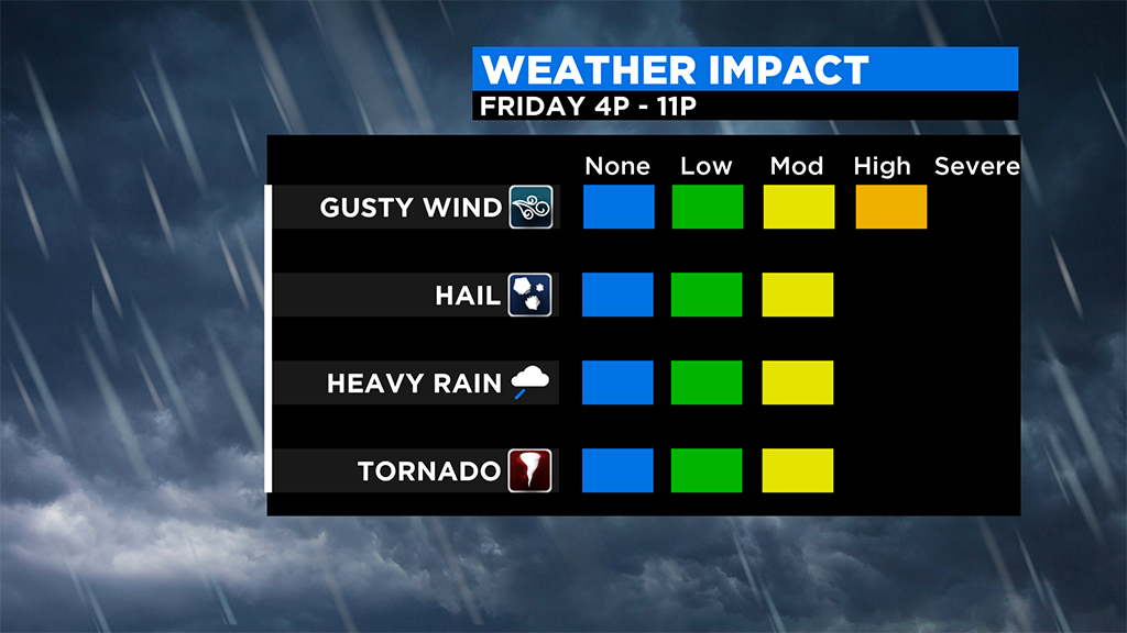
Main risk this evening is for damaging wind gusts, but an isolated tornado can't be ruled out NW of Boston. Here's a reminder of the difference between a watch/warning. #wbz pic.twitter.com/LMQTtdOYiP
— Eric Fisher (@ericfisher) May 15, 2020
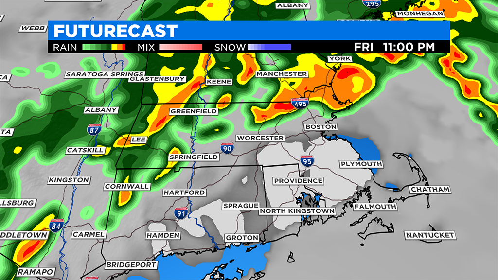
By late afternoon, we expect some showers and thunderstorms to develop to the west. We will be watching western and central Mass. between 1-4 p.m. to see how much convection fires up, and anytime after 4 p.m. we will be under the gun in eastern Mass. for severe thunderstorms.
Initially the storms are likely to be scattered in nature but later in the evening, most models are pointing towards a large complex of downpours and thunderstorms, mainly north and west of Boston.
NEW: Here's the Tornado Watch, up until 10pm tonight. For our area mostly watching for after 7pm. #wbz pic.twitter.com/TnKi2XCMdY
— Eric Fisher (@ericfisher) May 15, 2020
These thunderstorms on Friday will have the potential to produce damaging winds, hail, torrential downpours, frequent lightning and even an isolated tornado.
A tornado watch has been issued until 10 pm for the following counties in Massachusetts: Berkshire; Franklin; Hampden; Hampshire; Essex; Middlesex; Worcester.
It is important that you stay tuned to WBZ-TV, CBSBoston.com and CBSN Boston for frequent updates throughout the day on Friday.
Follow Terry On Twitter @TerryWBZ