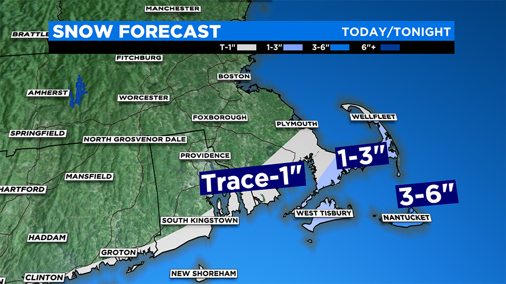
Cape Cod, Islands Could See Up To 3+ Inches Of Snow Monday Evening
BOSTON (CBS) -- We had a close call with a sizeable storm on Monday. It's amazing how a few miles can make such a big difference.
Had Monday's storm track been just a bit tighter to the coastline, we would have been plowing snow across a good portion of southern New England. Instead, the Cape and Islands are just getting scraped by the northern fringes of a nor'easter today.
The snow will make its greatest push north Monday afternoon and early evening, perhaps reaching as far north as the Cape Cod Canal for a few hours. By 8-to-10 p.m. Monday it will already be exiting the area.
Expect at most 1-to-3 inches across parts of the Cape and Islands, with perhaps a bit more over Nantucket. North of the canal, into Plymouth and up through the South Shore, there could be some light ocean-effect snow from time to time.
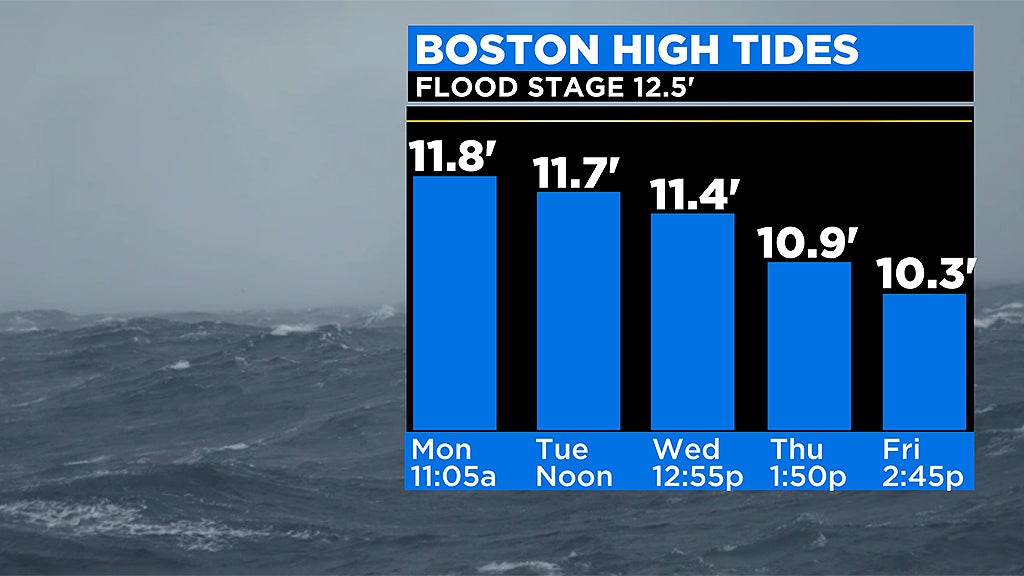
One final note on Monday's weather - tides will be very high astronomically. With an onshore wind, there will be some minor splash over and inundation in the typically prone areas to flooding.
We're back to quiet and cold on Tuesday, but an active, fast-moving weather pattern persists for the rest of the week with rain likely on Wednesday and perhaps a more significant storm early on Friday.
Follow Terry on Twitter @TerryWBZ