Severe Thunderstorm Watch Issued For End Of Heat Wave
BOSTON (CBS) - The final day of June is the final day of the heat wave. Wednesday also comes along with another record breaking high temperature.
The initial record at Logan Airport for June 30th, set back in 1945, was 95 degrees. On Wednesday, that record was broken, as it reached 100 degrees in Boston around 3 p.m.
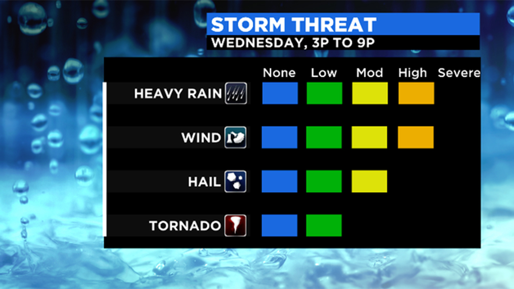
The heat and humidity have primed up the atmosphere for showers and storms. There may be some initial activity near 2 p.m., however the strongest storms likely occur from 6-to-10 p.m.
A severe thunderstorm watch is in effect for all of Massachusetts except the Cape & Islands through 10 p.m.
The main threats from this quick wave will be heavy rain and straight line wind potential. Within the strongest cells, 40-to-60 mph gusts are possible. That would likely bring down branches and even full trees. Prepare for some power outages Wednesday night. Thankfully this is after the rush of the evening commute so travel times shouldn't be impacted too much.
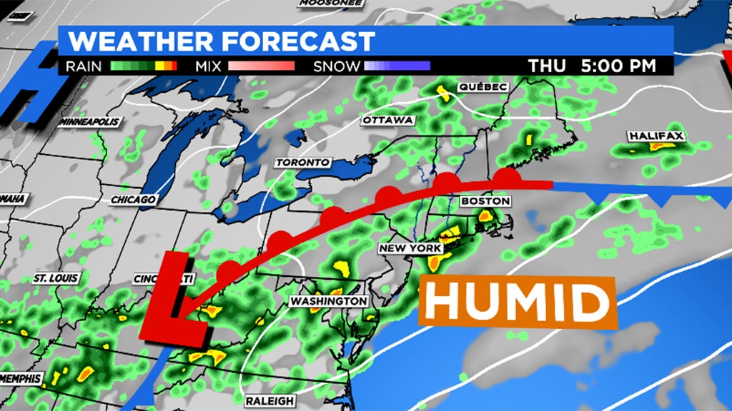
Relief wants to arrive on Thursday, however a cold front doesn't exactly slide through. The muggy conditions hold on as showers continue through the afternoon.
The lower humidity finally arrives on Friday as temperatures drop into the 60s! The cooler conditions stick around for the 4th of July weekend.