Rain And Wind Will Clear Out, But Temperatures Will Drop
BOSTON (CBS) - We're tracking a sweeping cold front that will bring wet and windy conditions Friday followed by clearing and dropping temperatures.
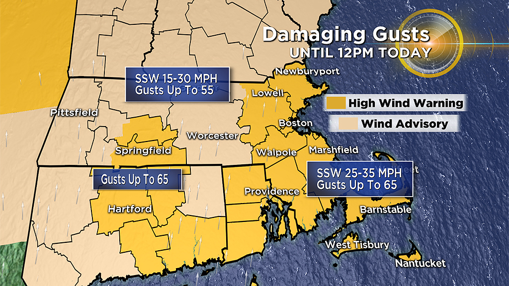
Here's what you can expect for wind:
After 7 a.m.: West 15-35 mph, gusts to 45 mph.
Afternoon: West 10-20 mph, gusts to 35 mph.
The wind will steadily lessen thereafter.
The peak of the storm arrived early Friday morning with the strongest winds and scattered downpours. There have been scattered power outages and numerous reports of downed limbs and trees.
The rain amounts were heaviest in northern New England, where they reached up to 3 inches. In southern New England, most areas were under an inch, so no major flooding has been reported.
If you are headed outside this morning, take it easy. Watch for cars and trucks that could potentially skid on wet leaves. There's also the chance of a wind gust bringing down some limbs.
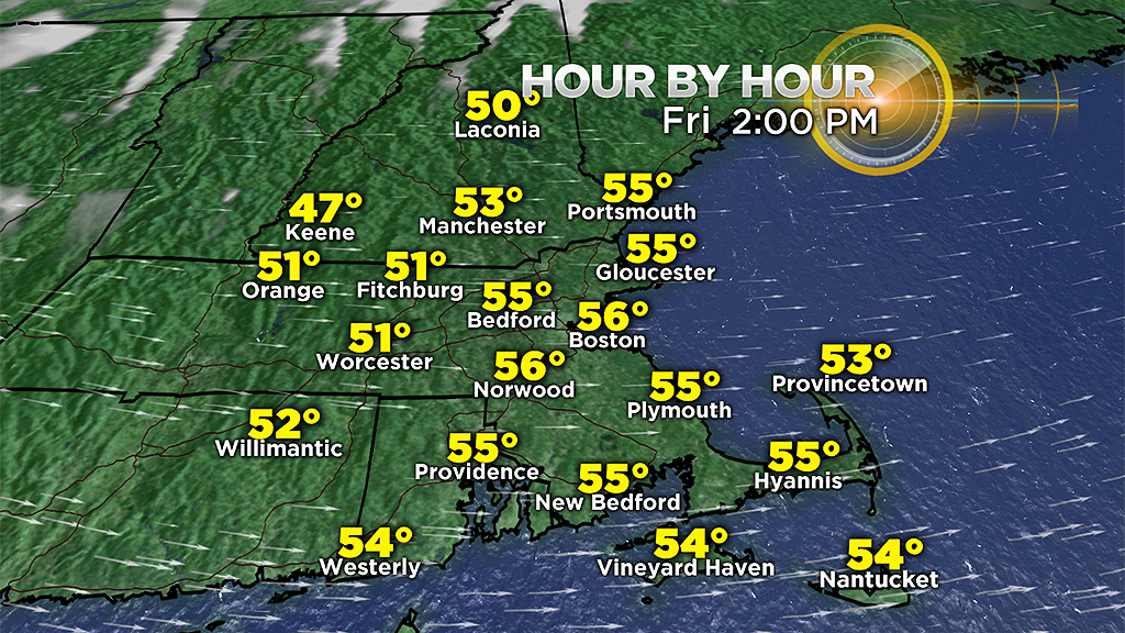
The rain will move out this morning and skies will gradually clear. It will turn brighter Friday afternoon, as temperatures drop from the mild 70s overnight to the 50s.
Expect 40s by this evening and a chilly night with potential frost in spots as we fall back into the 30s.
For continued updates on the forecast tune to WBZ-TV, CBSBoston.com and CBSN Boston.