Backdoor Front Arrives Tuesday
I know yesterday's weather was a bit of a disappointment. Despite the clouds and showers, we still managed to climb well into the 70s in many communities.
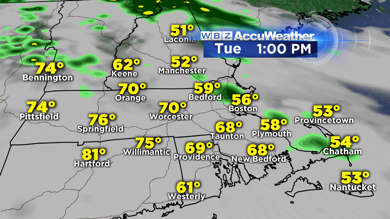
Today, the dreaded backdoor cold front will arrive to southern New England. You know what that means…the wind shifts to come in off the cool ocean and temperatures actually fall through the day. Coastal communities will drop from the 60s through the 50s while inland towns come into the 70s early then slide to the 60s and eventually 50s by evening.
This clash of temperatures also means clouds fill in and showers develop, so have the umbrella on standby today. Thunderstorms will develop in the warmth across NY and western New England but shouldn't survive the trip into eastern MA with the stable ocean air in place. Some steady rain may impact the tail end of the evening commute, mainly north and west of Boston. Overnight, pockets of rain will linger, eventually dwindling to showers by Wednesday morning's commute.
Temperatures will average about 15 degrees below the normal tomorrow and clouds will break for some late day sunshine as high pressure noses its way down from Canada. That big blue H on the map will provide us with more sunshine on Thursday and a slight rebound in temps (60s) before more significant warming arrives for the start of next week.
Sunday looks like it's the pick of the upcoming weekend. Here's any early look:
We'll keep you posted!
-Danielle