Tornado Touches Down In Howard Co. During Violent Storms, NWS says
BALTIMORE (WJZ) --The National Weather Service confirms a tornado did touch down in the Howard County area Tuesday afternoon as violent storms swept across the entire state.
The EF-0 tornado, with wind speeds of approximately 80 mph crossed one mile southwest of Poplar Springs in Howard County around 1:29 p.m. - 1:48 p.m. Tuesday.
Clean up is now underway after powerful storms whipper across the region, including Howard County where a tree came barreling down onto a home with kids inside."
"The two that were here were very lucky. That's the first question you ask and that's the only questions you ask," said the homeowner Todd.
Across the county in Ellicot City the trail of damage continued.
Sue Shebeo's car was buried by multiple trees.
"It's a car, it's not a person, so it's just a lot of clean up but it could have been a lot worse."
Kids in West Friendship recount the scary experience with WJZ saying they hid inside their home until the violent storms passed.
Some viewers even saw some hail failing from the sky, like this image captured in Edgewater.
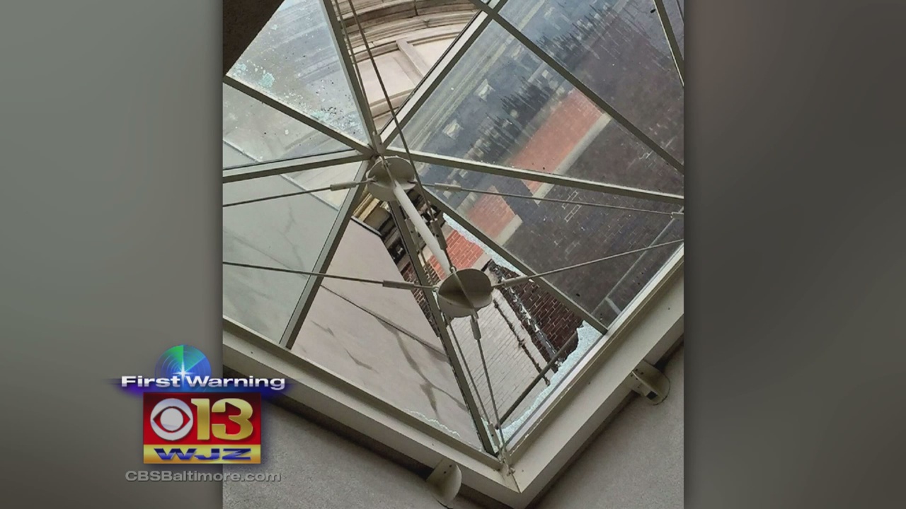
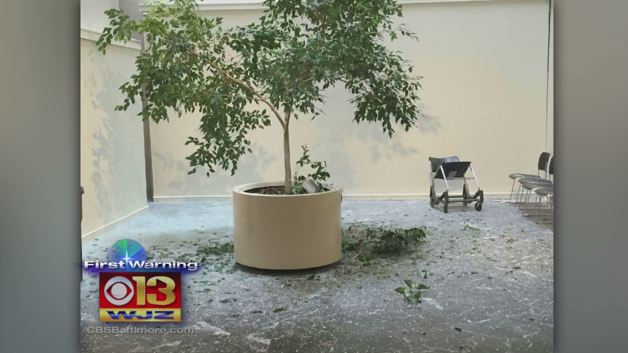
In Baltimore a possible lightning strike to City Hall may have caused two large pieces of marble to fall from molding on roof ledge and break through three panes of glass on the South side atrium.
City officials say there was damage to South rotunda wall and large tree pot in the atrium.
No one was hurt when the incident occurred. Estimates of the cost to repair were not immediately available.
And in the nation's capital video captured on Twitter appears to show the "elevator raining" at the U.S. Capitol building.
RELATED: PHOTOS: Strong Storms Roll Through Maryland
Some outages remain as crews work to cleanup after the devastation. At last check BGE reported at least 12,000 people without power.
To report an outage, or check the map CLICK HERE.
Follow @CBSBaltimore on Twitter and like WJZ-TV | CBS Baltimore on Facebook