Tropical Storm Fay makes landfall north of Atlantic City, lashing East Coast with heavy rain
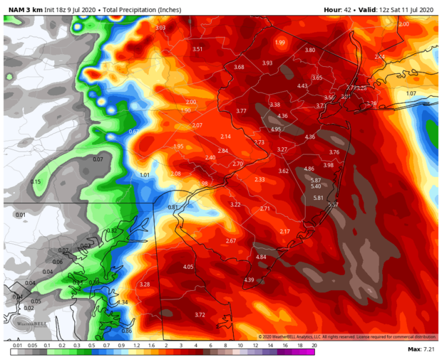
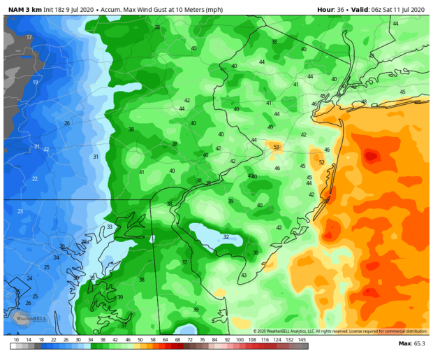
Tropical Storm Fay made landfall near Atlantic City, New Jersey, on Friday afternoon as it lashed the East Coast with heavy rainfall and strong winds. The storm continued to weaken as it moved into northern New Jersey on Friday night, the National Hurricane Center said in its 11 p.m. advisory.
The storm was located about 15 miles northwest of New York City, and was moving north at about 17 miles per hour, the hurricane center said. It has maximum sustained winds of about 40 miles per hour and will likely produce 1 to 3 inches of rain throughout much of the northeast.
The center of Fay will move across southeastern New York, then across western New England and into southeastern Canada on Saturday. The storm is expected to weaken on Saturday and dissipate by Sunday.
Tropical storm warnings have been issued for East Rockaway, New York, to Watch Hill, Rhode Island, including Long Island and Long Island Sound.
Fay, the sixth named system of this year's Atlantic hurricane season, formed Thursday afternoon just east of Cape Hatteras, North Carolina. The storm system breaks the record for the earliest sixth named storm in the Atlantic basin by almost two weeks.
The storm will generally miss Washington, D.C., and Baltimore to the east with only a little rain expected there. The storm is very compact but contains a lot of moisture.
With sea surface temperatures along its path barely at warm enough levels to support a tropical storm, and with its proximity to land and increasing forward motion, the system is not likely to become very strong.
Already off to a rapid start, the 2020 Atlantic hurricane season is threatening to be one of the most active in history.
Colorado State University released an updated seasonal forecast Tuesday increasing its projection of the total number of named storms from 16 to 20 — a large jump. (Normal is 12.) If 20 occur, that would tie for the second most active season in terms of storm number. The CSU forecast also calls for nine hurricanes and four major hurricanes, both above normal.
There are three main reasons for the expected active season. In the Pacific Ocean a weak La Niña may form, which typically is associated with more activity in the Atlantic Ocean. Also, rainfall across northwest Africa has been far above normal. Lastly, and most importantly, water temperatures in the Atlantic are far above normal, providing more fuel for growing storms.
Justin Carissimo and Victoria Albert contributed to this report.