Atlas 5 launches civilian imaging satellite
A United Launch Alliance Atlas 5 rocket boosted a sophisticated commercial imaging satellite into orbit Friday, a for-profit surveillance station equipped with a powerful camera capable of resolving objects slightly larger than a football anywhere on the surface of the planet.
Running nearly two months late because of a major wildfire near the launch pad in September, the Atlas 5’s Russian-built RD-180 first stage engine ignited at 1:30 p.m. EST (GMT-5; 10:30 a.m. local time) and a moment later, the 194-foot-tall rocket began climbing away from launch complex 3 at Vandenberg Air Force Base northwest of Los Angeles.
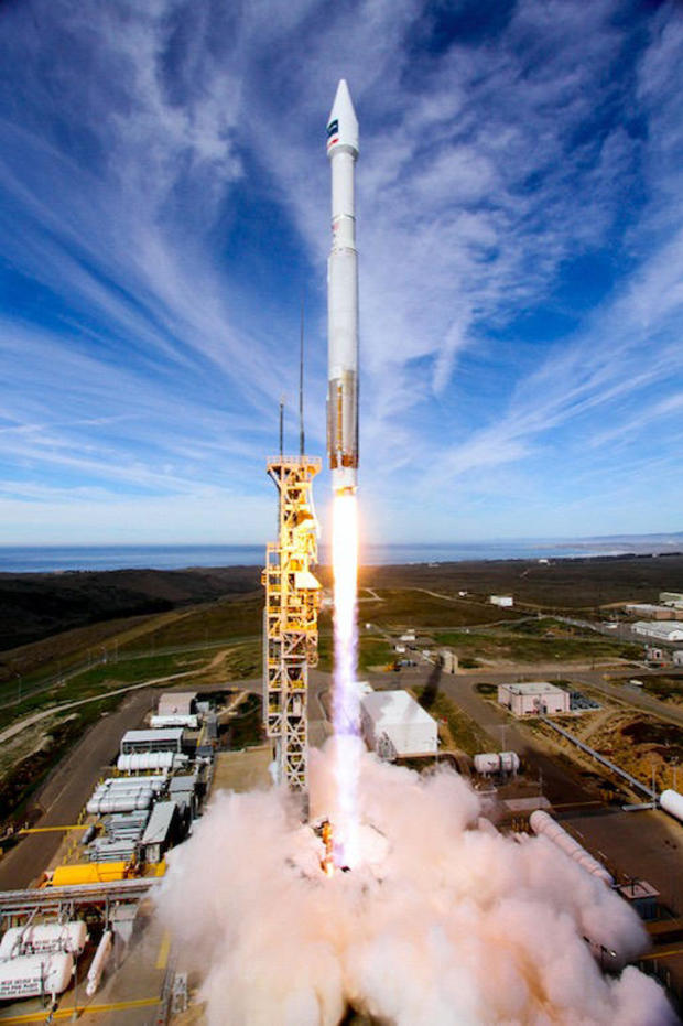
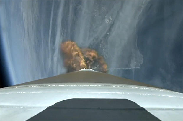
Arcing away to the southwest over the Pacific Ocean, the rocket rapidly accelerated through the mid-morning sky as it consumed its load of first-stage liquid oxygen and kerosene propellants, sending back spectacular “rocketcam” views of the California coast dropping away below.
Fifteen-and-a-half minutes after liftoff, the Centaur second stage’s Aerojet Rocketdyne RL10C engine shut down and four minutes after that, DigitalGlobe’s WorldView-4 satellite was released to fly on its own in a 383-mile high orbit around Earth’s poles. From that orbit, the satellite will fly over every point on the globe as the Earth rotates below.
Launch originally was planned for mid September, but the flight was delayed by an out-of-control wildfire that eventually scorched some 12,500 acres at the California launch site. The rocket and its satellite payload were not damaged, but power and communications equipment at the base had to be repaired, pushing launch to Nov. 6. Another delay was ordered to resolve an unspecified booster issue.
But it was clear sailing Friday as the Atlas 5 chalked up its 66th successful launch since the booster’s debut in 2002 and the 112th straight success for United Launch Alliance, which also builds the Delta 4 family of rockets. The WorldView-4 launching was ULA’s 15th commercial mission.
Built by Lockheed Martin, WorldView-4 joins four other DigitalGlobe-owned imaging satellites already in orbit, a state-of-the-art spacecraft that will roughly double the company’s collection of ultra-sharp pictures of political hot spots, cities, environmentally stressed regions, natural disasters and other areas of interest.
The new satellite features a telescope with a 3.6-foot-wide mirror, the heart of an imaging system provided by Harris Corp. that can resolve surface features as small as 31 centimeters across, or about 1 foot, from a distance of 383 miles.
It can pinpoint the location of a sharply-resolved ground target to within about 3 yards and it is equipped with sophisticated gyroscopes that allow the spacecraft to quickly shift from one target to another, allowing it to photograph 262,000 square miles of territory per day.
“WorldView-4 basically doubles our capacity for the highest quality imagery,” said Taner Kodanaz, a senior manager with DigitalGlobe. “With accuracy of 3 meters, you can be assured that what you see in an image is exactly where you see it on the ground. By resolution, 31 centimeters provides more than three times the information per shot than that provided by 50-centimeter (imagery).”
Until a few years ago, the U.S. government limited the resolution of commercial imaging satellites to 50 centimeters, or about 20 inches. But “there was a significant change to the regulations ... that relaxed what are called resolution restrictions from 50-centimeter imagery to 25-centimeter imagery,” DigitalGlobe CEO Jeffrey Tarr said in an interview earlier this week.
He said the relaxed restrictions on resolution allowed DigitalGlobe’s WorldView-3 satellite, launched two years ago, “to bring to market for the first time this ultra-high-resolution imagery.”
“And what we found is that there is a demand out there that we’ve been unable to meet with just WorldView-3, especially over the most volatile parts of the world,” Tarr said. “We lined up a group of customers ... to purchase the capacity of WorldView-4.”
While WorldView-4’s customers are primarily U.S. government and allied defense and intelligence agencies, “there’s increasing interest in very high-resolution imagery over, for example, the world’s major (cities),” Tarr said. “With this additional capacity, we’ll be able to image and update those metros on a more frequent basis, and we believe that will also unlock new applications and new opportunities.”
To put the Harris SpaceView 110 camera into perspective, Rob Mitrevski, vice president and general manager of the company’s intelligence, surveillance and reconnaissance unit, said the distance between Harris’ manufacturing facility in Rochester, New York, is as far from Washington, D.C. as WorldView-4 will be from the Earth’s surface.
“If the world was flat, and I pointed the imaging system in Rochester toward Washington, I could from a very safe distance enjoy watching presidential election-year politics from the comfort of my own facility in all that 31-centimeter resolution,” he said. “What a great capability that is.
“But we can also enable serious, relevant missions for countries and people, including those requiring greater global transparency, like natural disasters, population migration and human rights abuses.”